Blackville Topo Map South Carolina
To zoom in, hover over the map of Blackville
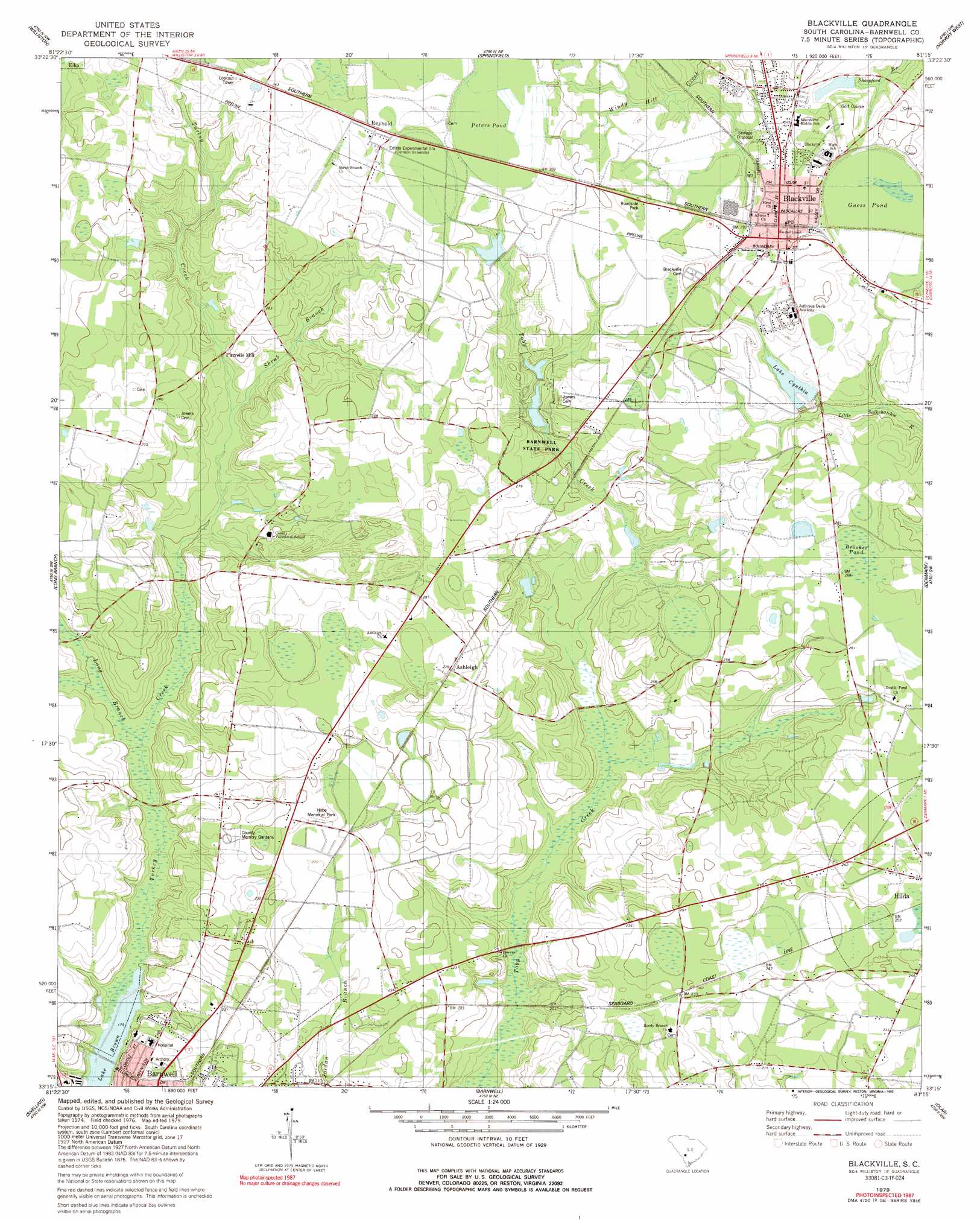
USGS Topo Quad 33081c3 - 1:24,000 scale
| Topo Map Name: | Blackville |
| USGS Topo Quad ID: | 33081c3 |
| Print Size: | ca. 21 1/4" wide x 27" high |
| Southeast Coordinates: | 33.25° N latitude / 81.25° W longitude |
| Map Center Coordinates: | 33.3125° N latitude / 81.3125° W longitude |
| U.S. State: | SC |
| Filename: | o33081c3.jpg |
| Download Map JPG Image: | Blackville topo map 1:24,000 scale |
| Map Type: | Topographic |
| Topo Series: | 7.5´ |
| Map Scale: | 1:24,000 |
| Source of Map Images: | United States Geological Survey (USGS) |
| Alternate Map Versions: |
Blackville SC 1979, updated 1980 Download PDF Buy paper map Blackville SC 1979, updated 1992 Download PDF Buy paper map Blackville SC 2011 Download PDF Buy paper map Blackville SC 2014 Download PDF Buy paper map |
1:24,000 Topo Quads surrounding Blackville
Oakwood |
Kitchings Mill |
Salley |
Harleys Millpond |
North |
Windsor |
Williston |
Springfield |
Norway West |
Norway East |
New Ellenton Se |
Long Branch |
Blackville |
Denmark |
Bamberg |
Girard Ne |
Snelling |
Barnwell |
Olar |
Clear Pond |
Millett |
Martin |
Allendale |
Sycamore |
Ehrhardt |
> Back to 33081a1 at 1:100,000 scale
> Back to 33080a1 at 1:250,000 scale
> Back to U.S. Topo Maps home
Blackville topo map: Gazetteer
Blackville: Dams
Edisto Pond Dam D-3061 elevation 88m 288′Lake Cynthia Dam D-3068 elevation 78m 255′
McLains Pond D-3058 Dam elevation 79m 259′
Blackville: Lakes
Guess Pond elevation 82m 269′Lake Brown elevation 55m 180′
Peters Pond elevation 93m 305′
Blackville: Parks
Barnwell State Park elevation 73m 239′Blackville: Populated Places
Ashleigh elevation 84m 275′Blackville elevation 89m 291′
Farrells Mill elevation 69m 226′
Reynold elevation 97m 318′
Yale (historical) elevation 70m 229′
Blackville: Post Offices
Blackville Post Office elevation 88m 288′Blackville: Reservoirs
Lake Cynthia elevation 79m 259′Blackville: Streams
Long Branch elevation 58m 190′Shrub Branch elevation 66m 216′
Blackville: Swamps
Booker Pond elevation 81m 265′Blackville digital topo map on disk
Buy this Blackville topo map showing relief, roads, GPS coordinates and other geographical features, as a high-resolution digital map file on DVD:
South Carolina, Western North Carolina & Northeastern Georgia
Buy digital topo maps: South Carolina, Western North Carolina & Northeastern Georgia