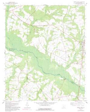
Norway West Topo Map South Carolina
To zoom in, hover over the map of Norway West
USGS Topo Quad 33081d2 - 1:24,000 scale
| Topo Map Name: | Norway West |
| USGS Topo Quad ID: | 33081d2 |
| Print Size: | ca. 21 1/4" wide x 27" high |
| Southeast Coordinates: | 33.375° N latitude / 81.125° W longitude |
| Map Center Coordinates: | 33.4375° N latitude / 81.1875° W longitude |
| U.S. State: | SC |
| Filename: | o33081d2.jpg |
| Download Map JPG Image: | Norway West topo map 1:24,000 scale |
| Map Type: | Topographic |
| Topo Series: | 7.5´ |
| Map Scale: | 1:24,000 |
| Source of Map Images: | United States Geological Survey (USGS) |
| Alternate Map Versions: |
Norway West SC 1979, updated 1991 Download PDF Buy paper map Norway West SC 2011 Download PDF Buy paper map Norway West SC 2014 Download PDF Buy paper map |
1:24,000 Topo Quads surrounding Norway West
> Back to 33081a1 at 1:100,000 scale
> Back to 33080a1 at 1:250,000 scale
> Back to U.S. Topo Maps home
Norway West topo map: Gazetteer
Norway West: Areas
Slaughter Field elevation 64m 209′Norway West: Bridges
Duncans Bridge (historical) elevation 53m 173′Holman Bridge (historical) elevation 55m 180′
Norway West: Dams
Collums Pond D-3071 Dam elevation 74m 242′Hairs Pond D-3060 Dam elevation 65m 213′
Little Ponderosa Lake Dam D-3748 elevation 65m 213′
Pardees Pond Dam D-3747 elevation 62m 203′
South Carolina Noname 38068 D-3764 Dam elevation 63m 206′
Norway West: Islands
Youngs Island elevation 54m 177′Norway West: Lakes
Nicks Lake (historical) elevation 57m 187′Norway West: Populated Places
Creco (historical) elevation 68m 223′Edisto Club elevation 55m 180′
Norway elevation 72m 236′
Sweden elevation 60m 196′
Waynor (historical) elevation 56m 183′
Norway West: Post Offices
Norway Post Office elevation 69m 226′Norway West: Streams
Bull Branch elevation 55m 180′Campbell Branch elevation 62m 203′
Dry Branch elevation 57m 187′
Goodland Creek elevation 55m 180′
Little River elevation 55m 180′
Pleasant Branch elevation 61m 200′
Rocky Swamp Creek elevation 56m 183′
Rogers Branch elevation 56m 183′
Sheepford Branch elevation 60m 196′
Snake Branch elevation 51m 167′
Sykes Swamp elevation 49m 160′
Tampa Creek elevation 62m 203′
Windy Hill Creek elevation 58m 190′
Norway West: Swamps
Cowford Lake elevation 56m 183′Norway West digital topo map on disk
Buy this Norway West topo map showing relief, roads, GPS coordinates and other geographical features, as a high-resolution digital map file on DVD:
South Carolina, Western North Carolina & Northeastern Georgia
Buy digital topo maps: South Carolina, Western North Carolina & Northeastern Georgia


