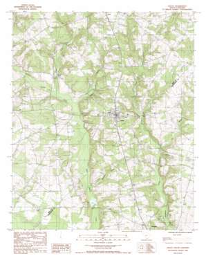
Salley Topo Map South Carolina
To zoom in, hover over the map of Salley
USGS Topo Quad 33081e3 - 1:24,000 scale
| Topo Map Name: | Salley |
| USGS Topo Quad ID: | 33081e3 |
| Print Size: | ca. 21 1/4" wide x 27" high |
| Southeast Coordinates: | 33.5° N latitude / 81.25° W longitude |
| Map Center Coordinates: | 33.5625° N latitude / 81.3125° W longitude |
| U.S. State: | SC |
| Filename: | o33081e3.jpg |
| Download Map JPG Image: | Salley topo map 1:24,000 scale |
| Map Type: | Topographic |
| Topo Series: | 7.5´ |
| Map Scale: | 1:24,000 |
| Source of Map Images: | United States Geological Survey (USGS) |
| Alternate Map Versions: |
Salley SC 1988, updated 1988 Download PDF Buy paper map Salley SC 2011 Download PDF Buy paper map Salley SC 2014 Download PDF Buy paper map |
1:24,000 Topo Quads surrounding Salley
> Back to 33081e1 at 1:100,000 scale
> Back to 33080a1 at 1:250,000 scale
> Back to U.S. Topo Maps home
Salley topo map: Gazetteer
Salley: Dams
Capers Mill Pond Dam D-0672 elevation 87m 285′Hartley Pond D-2035 Dam elevation 86m 282′
South Carolina Noname 02019 D-2034 Dam elevation 95m 311′
South Carolina Noname 02064 D-2144 Dam elevation 84m 275′
South Carolina Noname 02086 D-2131 Dam elevation 98m 321′
South Carolina Noname 02110 D-2133 Dam elevation 97m 318′
South Carolina Noname 38005 D-3726 Dam elevation 68m 223′
Salley: Populated Places
Salley elevation 114m 374′Salley: Post Offices
Salley Post Office elevation 114m 374′Salley: Reservoirs
Baileys Pond elevation 95m 311′Capers Mill Pond elevation 87m 285′
Dean Swamp Pond elevation 68m 223′
Hartley Pond elevation 86m 282′
Johnsons Pond elevation 97m 318′
Johnsons Pond elevation 98m 321′
Lake Maxine elevation 84m 275′
Miller Pond elevation 97m 318′
Millers Pond elevation 81m 265′
Salley: Streams
Abrams Branch elevation 74m 242′Bratcher Branch elevation 70m 229′
Gin Branch elevation 75m 246′
Jordan Creek elevation 75m 246′
Salley digital topo map on disk
Buy this Salley topo map showing relief, roads, GPS coordinates and other geographical features, as a high-resolution digital map file on DVD:
South Carolina, Western North Carolina & Northeastern Georgia
Buy digital topo maps: South Carolina, Western North Carolina & Northeastern Georgia


