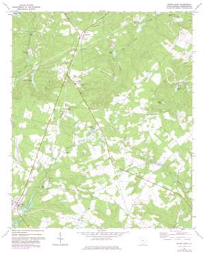
Pelion East Topo Map South Carolina
To zoom in, hover over the map of Pelion East
USGS Topo Quad 33081g2 - 1:24,000 scale
| Topo Map Name: | Pelion East |
| USGS Topo Quad ID: | 33081g2 |
| Print Size: | ca. 21 1/4" wide x 27" high |
| Southeast Coordinates: | 33.75° N latitude / 81.125° W longitude |
| Map Center Coordinates: | 33.8125° N latitude / 81.1875° W longitude |
| U.S. State: | SC |
| Filename: | o33081g2.jpg |
| Download Map JPG Image: | Pelion East topo map 1:24,000 scale |
| Map Type: | Topographic |
| Topo Series: | 7.5´ |
| Map Scale: | 1:24,000 |
| Source of Map Images: | United States Geological Survey (USGS) |
| Alternate Map Versions: |
Pelion East SC 1972, updated 1974 Download PDF Buy paper map Pelion East SC 1972, updated 1982 Download PDF Buy paper map Pelion East SC 1972, updated 1982 Download PDF Buy paper map Pelion East SC 2011 Download PDF Buy paper map Pelion East SC 2014 Download PDF Buy paper map |
1:24,000 Topo Quads surrounding Pelion East
> Back to 33081e1 at 1:100,000 scale
> Back to 33080a1 at 1:250,000 scale
> Back to U.S. Topo Maps home
Pelion East topo map: Gazetteer
Pelion East: Airports
Corporate Airport elevation 139m 456′Darden Airport elevation 132m 433′
Falcon Airport elevation 159m 521′
Pelion East: Dams
Guignard Pond Dam D-0974 elevation 71m 232′South Carolina Noname 32007 D-0972 Dam elevation 102m 334′
South Carolina Noname 32018 D-0976 Dam elevation 90m 295′
South Carolina Noname 32019 D-0977 Dam elevation 90m 295′
South Carolina Noname 32025 D-0978 Dam elevation 118m 387′
South Carolina Noname 32026 D-0975 Dam elevation 77m 252′
South Carolina Noname 32033 D-0971 Dam elevation 90m 295′
South Carolina Noname 32035 D-0955 Dam elevation 92m 301′
Pelion East: Lakes
Craft Pond elevation 148m 485′Hollow Pond elevation 117m 383′
Hutto Pond elevation 102m 334′
Rast Pond elevation 98m 321′
Schumpert Pond elevation 65m 213′
Shealy Pond elevation 74m 242′
Pelion East: Populated Places
Edmund elevation 141m 462′Macedon elevation 147m 482′
Pelion elevation 118m 387′
Sharpes Hill elevation 142m 465′
Testo elevation 126m 413′
Pelion East: Reservoirs
Crystal Springs Lake elevation 90m 295′Feagles Pond elevation 77m 252′
Feigles Pond elevation 77m 252′
Fort Pond elevation 102m 334′
Friendship Lake elevation 92m 301′
Goodwin Pond elevation 91m 298′
Goodwin Pond elevation 90m 295′
Guignard Pond elevation 71m 232′
Hobson Pond elevation 151m 495′
Moragne Pond elevation 76m 249′
Redmond Pond elevation 77m 252′
Spires Pond elevation 118m 387′
Pelion East: Streams
Bear Creek elevation 64m 209′Boggy Branch elevation 100m 328′
East Fork Scouter Branch elevation 81m 265′
Hunt Branch elevation 78m 255′
Lynch Branch elevation 102m 334′
West Fork Scouter Branch elevation 81m 265′
Pelion East digital topo map on disk
Buy this Pelion East topo map showing relief, roads, GPS coordinates and other geographical features, as a high-resolution digital map file on DVD:
South Carolina, Western North Carolina & Northeastern Georgia
Buy digital topo maps: South Carolina, Western North Carolina & Northeastern Georgia


