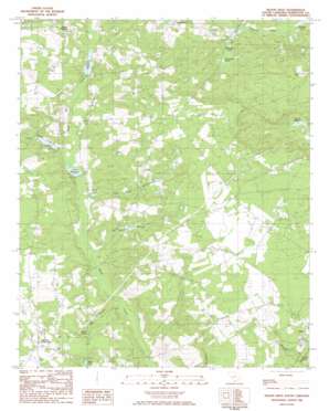
Fairview Crossroads Topo Map South Carolina
To zoom in, hover over the map of Fairview Crossroads
USGS Topo Quad 33081g3 - 1:24,000 scale
| Topo Map Name: | Fairview Crossroads |
| USGS Topo Quad ID: | 33081g3 |
| Print Size: | ca. 21 1/4" wide x 27" high |
| Southeast Coordinates: | 33.75° N latitude / 81.25° W longitude |
| Map Center Coordinates: | 33.8125° N latitude / 81.3125° W longitude |
| U.S. State: | SC |
| Filename: | o33081g3.jpg |
| Download Map JPG Image: | Fairview Crossroads topo map 1:24,000 scale |
| Map Type: | Topographic |
| Topo Series: | 7.5´ |
| Map Scale: | 1:24,000 |
| Source of Map Images: | United States Geological Survey (USGS) |
| Alternate Map Versions: |
Pelion West SC 1986, updated 1986 Download PDF Buy paper map Pelion West SC 2011 Download PDF Buy paper map Pelion West SC 2014 Download PDF Buy paper map |
1:24,000 Topo Quads surrounding Fairview Crossroads
> Back to 33081e1 at 1:100,000 scale
> Back to 33080a1 at 1:250,000 scale
> Back to U.S. Topo Maps home
Fairview Crossroads topo map: Gazetteer
Fairview Crossroads: Airports
Eagles Nest-Fairview Airpark elevation 134m 439′Fairview Crossroads: Dams
Areharts Pond Dam D-1716 elevation 112m 367′Ballingtons Pond Dam D-1704 elevation 88m 288′
South Carolina Noname 32012 D-0948 Dam elevation 110m 360′
South Carolina Noname 32013 D-0949 Dam elevation 132m 433′
South Carolina Noname 32034 D-0973 Dam elevation 109m 357′
South Carolina Noname 32054 D-0947 Dam elevation 126m 413′
South Carolina Noname 32055 D-1000 Dam elevation 105m 344′
South Carolina Noname 32103 D-1707 Dam elevation 90m 295′
Fairview Crossroads: Populated Places
Fairview Crossroads elevation 143m 469′Fairview Crossroads: Reservoirs
Ballington Pond elevation 91m 298′Ballingtons Pond elevation 88m 288′
Beaverdam Pond elevation 93m 305′
Clarks Millpond elevation 132m 433′
Clarks Millpond elevation 102m 334′
Crout Pond elevation 126m 413′
Dunbar Pond elevation 100m 328′
Fowles Pond elevation 112m 367′
Harmons Pond elevation 105m 344′
Huffman Burnt Millpond elevation 93m 305′
Lucas Millpond elevation 94m 308′
McIver Pond elevation 113m 370′
Paxton Millpond elevation 110m 360′
Rast Pond elevation 109m 357′
Smiths Millpond elevation 119m 390′
Fairview Crossroads: Streams
Big Branch elevation 90m 295′Cedar Pond Branch elevation 99m 324′
Little Black Creek elevation 102m 334′
Pond Branch elevation 113m 370′
Smith Branch elevation 88m 288′
Spring Branch elevation 93m 305′
Fairview Crossroads digital topo map on disk
Buy this Fairview Crossroads topo map showing relief, roads, GPS coordinates and other geographical features, as a high-resolution digital map file on DVD:
South Carolina, Western North Carolina & Northeastern Georgia
Buy digital topo maps: South Carolina, Western North Carolina & Northeastern Georgia


