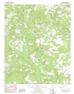
Steedman Topo Map South Carolina
To zoom in, hover over the map of Steedman
USGS Topo Quad 33081g4 - 1:24,000 scale
| Topo Map Name: | Steedman |
| USGS Topo Quad ID: | 33081g4 |
| Print Size: | ca. 21 1/4" wide x 27" high |
| Southeast Coordinates: | 33.75° N latitude / 81.375° W longitude |
| Map Center Coordinates: | 33.8125° N latitude / 81.4375° W longitude |
| U.S. State: | SC |
| Filename: | o33081g4.jpg |
| Download Map JPG Image: | Steedman topo map 1:24,000 scale |
| Map Type: | Topographic |
| Topo Series: | 7.5´ |
| Map Scale: | 1:24,000 |
| Source of Map Images: | United States Geological Survey (USGS) |
| Alternate Map Versions: |
Steedman SC 1986, updated 1986 Download PDF Buy paper map Steedman SC 2011 Download PDF Buy paper map Steedman SC 2014 Download PDF Buy paper map |
1:24,000 Topo Quads surrounding Steedman
> Back to 33081e1 at 1:100,000 scale
> Back to 33080a1 at 1:250,000 scale
> Back to U.S. Topo Maps home
Steedman topo map: Gazetteer
Steedman: Bridges
Francis Cyril Jones Bridge elevation 102m 334′Rayflin Bridge elevation 91m 298′
Steedman Bridge elevation 96m 314′
Steedman: Crossings
Interchange 39 elevation 121m 396′Interchange 44 elevation 141m 462′
Steedman: Dams
Scotts Pond Dam D-2146 elevation 104m 341′South Carolina Noname 02079 D-2139 Dam elevation 113m 370′
South Carolina Noname 32056 D-0943 Dam elevation 115m 377′
South Carolina Noname 32057 D-0942 Dam elevation 110m 360′
South Carolina Noname 32058 D-0941 Dam elevation 119m 390′
South Carolina Noname 32061 D-0936 Dam elevation 128m 419′
South Carolina Noname 32062 D-1002 Dam elevation 99m 324′
South Carolina Noname 32063 D-0938 Dam elevation 138m 452′
South Carolina Noname 32064 D-1712 Dam elevation 107m 351′
South Carolina Noname 32069 D-1001 Dam elevation 103m 337′
South Carolina Noname 32070 D-0937 Dam elevation 102m 334′
South Carolina Noname 32071 D-0998 Dam elevation 151m 495′
South Carolina Noname 32092 D-0999 Dam elevation 121m 396′
Steedman: Populated Places
Althea (historical) elevation 110m 360′Hall (historical) elevation 130m 426′
Mims elevation 151m 495′
Rayflin elevation 101m 331′
Samaria elevation 127m 416′
Steedman elevation 104m 341′
Steedman: Reservoirs
Abells Millpond elevation 128m 419′Bauknight Pond elevation 110m 360′
Bouknight Pond elevation 110m 360′
Brodie Millpond elevation 125m 410′
Collum Pond elevation 119m 390′
Collums Pond elevation 113m 370′
Cones Pond elevation 103m 337′
Hall Pond elevation 121m 396′
Hallman Millpond elevation 130m 426′
Johnson Pond elevation 115m 377′
Jones Pond elevation 114m 374′
Kirklands Pond elevation 107m 351′
Kneece Pond elevation 101m 331′
Old Rowe Pond elevation 102m 334′
Old Rowe School elevation 114m 374′
Ridgells Pond elevation 99m 324′
Scotts Pond elevation 104m 341′
Smith Pond elevation 96m 314′
Steedman Pond elevation 99m 324′
Steedman Pond elevation 138m 452′
Steedman: Streams
Carneys Creek elevation 95m 311′Chinquapin Creek elevation 98m 321′
Crooker Branch elevation 95m 311′
Goose Platter Creek elevation 92m 301′
Hellhole Creek elevation 124m 406′
Lightwood Knot Creek elevation 95m 311′
Long Branch elevation 101m 331′
Marlowe Creek elevation 123m 403′
Mill Creek elevation 102m 334′
Shirley Branch elevation 98m 321′
Thrasher Branch elevation 104m 341′
Steedman digital topo map on disk
Buy this Steedman topo map showing relief, roads, GPS coordinates and other geographical features, as a high-resolution digital map file on DVD:
South Carolina, Western North Carolina & Northeastern Georgia
Buy digital topo maps: South Carolina, Western North Carolina & Northeastern Georgia


