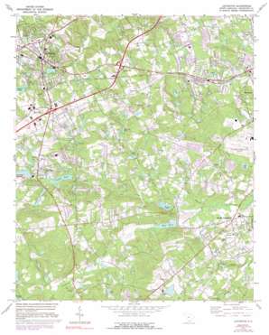
Lexington Topo Map South Carolina
To zoom in, hover over the map of Lexington
USGS Topo Quad 33081h2 - 1:24,000 scale
| Topo Map Name: | Lexington |
| USGS Topo Quad ID: | 33081h2 |
| Print Size: | ca. 21 1/4" wide x 27" high |
| Southeast Coordinates: | 33.875° N latitude / 81.125° W longitude |
| Map Center Coordinates: | 33.9375° N latitude / 81.1875° W longitude |
| U.S. State: | SC |
| Filename: | o33081h2.jpg |
| Download Map JPG Image: | Lexington topo map 1:24,000 scale |
| Map Type: | Topographic |
| Topo Series: | 7.5´ |
| Map Scale: | 1:24,000 |
| Source of Map Images: | United States Geological Survey (USGS) |
| Alternate Map Versions: |
Lexington SC 1972, updated 1974 Download PDF Buy paper map Lexington SC 1972, updated 1983 Download PDF Buy paper map Lexington SC 1972, updated 1992 Download PDF Buy paper map Lexington SC 2011 Download PDF Buy paper map Lexington SC 2014 Download PDF Buy paper map |
1:24,000 Topo Quads surrounding Lexington
> Back to 33081e1 at 1:100,000 scale
> Back to 33080a1 at 1:250,000 scale
> Back to U.S. Topo Maps home
Lexington topo map: Gazetteer
Lexington: Crossings
Interchange 55 elevation 123m 403′Interchange 58 elevation 107m 351′
Lexington: Dams
Lexington Mill Pond Dam elevation 87m 285′Shealys Pond Dam D-1718 elevation 79m 259′
South Carolina Noname 32002 D-0960 Dam elevation 92m 301′
South Carolina Noname 32004 D-0969 Dam elevation 76m 249′
South Carolina Noname 32009 D-0961 Dam elevation 78m 255′
South Carolina Noname 32010 D-0966 Dam elevation 56m 183′
South Carolina Noname 32015 D-1719 Dam elevation 53m 173′
South Carolina Noname 32028 D-0965 Dam elevation 53m 173′
South Carolina Noname 32030 D-0959 Dam elevation 95m 311′
South Carolina Noname 32031 D-0962 Dam elevation 90m 295′
South Carolina Noname 32076 D-0963 Dam elevation 89m 291′
South Carolina Noname 32091 D-0967 Dam elevation 101m 331′
Lexington: Lakes
Shealy Pond elevation 80m 262′Lexington: Populated Places
Arthur elevation 96m 314′Baskin Hills elevation 89m 291′
Blue Ridge Terrace elevation 111m 364′
Cedar Estates elevation 86m 282′
Cedarwood elevation 59m 193′
Congaree (historical) elevation 80m 262′
Congaree Gardens elevation 70m 229′
Coventry Woods elevation 116m 380′
Crystal View elevation 73m 239′
Dutchman Acres elevation 74m 242′
Greyland Forest elevation 102m 334′
Hamlet South elevation 88m 288′
Hamlet West elevation 98m 321′
Harrisburg elevation 125m 410′
Heritage Hills elevation 107m 351′
Hillside elevation 112m 367′
Honeywood elevation 94m 308′
Indian Pines elevation 116m 380′
Kings Grant elevation 100m 328′
Lakeview Terrace elevation 109m 357′
Lakewood elevation 127m 416′
Land of the Lakes elevation 88m 288′
Lexington elevation 120m 393′
Lexington Woods elevation 120m 393′
Melwood elevation 93m 305′
Oak Crest elevation 97m 318′
Oak Grove elevation 103m 337′
Oak Grove Estates elevation 111m 364′
Oakridge elevation 129m 423′
Oakwood elevation 115m 377′
Parkwood elevation 90m 295′
Peachtree Acres elevation 111m 364′
Red Bank elevation 104m 341′
Regency Square elevation 113m 370′
Rose Gardens elevation 100m 328′
Shuler (historical) elevation 98m 321′
South Congaree elevation 58m 190′
Southgate elevation 112m 367′
Spring Hill elevation 103m 337′
Three Fountains elevation 83m 272′
Walnut Creek elevation 75m 246′
Woodsen elevation 100m 328′
Wrenwood elevation 112m 367′
Lexington: Reservoirs
Armour Pond elevation 56m 183′Arrants Pond elevation 90m 295′
Carroll Pond elevation 70m 229′
Crystal Lake elevation 78m 255′
Durham Pond elevation 91m 298′
Durham Pond elevation 53m 173′
Eden Pond elevation 80m 262′
Fisher Pond elevation 92m 301′
Gibsons Pond elevation 95m 311′
Harmon Pond elevation 81m 265′
Hunt Pond elevation 58m 190′
Hunt Pond elevation 56m 183′
Lake Durham elevation 53m 173′
Lawn Pond elevation 70m 229′
Lexington Mill Pond elevation 87m 285′
Martin Pond elevation 82m 269′
Pennsylvania Glass Sand Settling Pond elevation 101m 331′
Pitts Lake elevation 53m 173′
Price Ponds elevation 91m 298′
Red Bank Mill Pond elevation 92m 301′
Redmonds Pond elevation 89m 291′
Roof Pond elevation 67m 219′
Ruff Ponds elevation 98m 321′
Saxe-Gotha Millpond elevation 84m 275′
Shealys Pond elevation 79m 259′
Sherman Pond elevation 82m 269′
Sox Ponds elevation 64m 209′
Vernett Pond elevation 63m 206′
Lexington: Streams
Lick Fork Branch elevation 55m 180′Pole Branch elevation 48m 157′
Red Bank Creek elevation 48m 157′
Reedy Branch elevation 52m 170′
Scouter Branch elevation 65m 213′
Lexington digital topo map on disk
Buy this Lexington topo map showing relief, roads, GPS coordinates and other geographical features, as a high-resolution digital map file on DVD:
South Carolina, Western North Carolina & Northeastern Georgia
Buy digital topo maps: South Carolina, Western North Carolina & Northeastern Georgia


