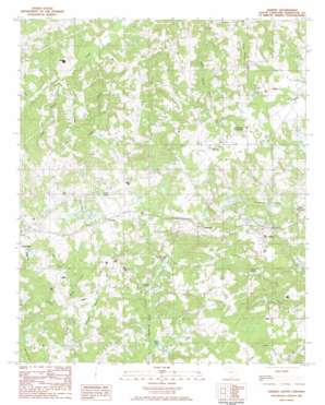
Gilbert Topo Map South Carolina
To zoom in, hover over the map of Gilbert
USGS Topo Quad 33081h4 - 1:24,000 scale
| Topo Map Name: | Gilbert |
| USGS Topo Quad ID: | 33081h4 |
| Print Size: | ca. 21 1/4" wide x 27" high |
| Southeast Coordinates: | 33.875° N latitude / 81.375° W longitude |
| Map Center Coordinates: | 33.9375° N latitude / 81.4375° W longitude |
| U.S. State: | SC |
| Filename: | o33081h4.jpg |
| Download Map JPG Image: | Gilbert topo map 1:24,000 scale |
| Map Type: | Topographic |
| Topo Series: | 7.5´ |
| Map Scale: | 1:24,000 |
| Source of Map Images: | United States Geological Survey (USGS) |
| Alternate Map Versions: |
Gilbert SC 1986, updated 1986 Download PDF Buy paper map Gilbert SC 2011 Download PDF Buy paper map Gilbert SC 2014 Download PDF Buy paper map |
1:24,000 Topo Quads surrounding Gilbert
> Back to 33081e1 at 1:100,000 scale
> Back to 33080a1 at 1:250,000 scale
> Back to U.S. Topo Maps home
Gilbert topo map: Gazetteer
Gilbert: Airports
Gilbert International Airport elevation 168m 551′Gilbert: Dams
South Carolina Noname 32059 D-0997 Dam elevation 142m 465′South Carolina Noname 32072 D-0935 Dam elevation 143m 469′
South Carolina Noname 32073 D-0940 Dam elevation 145m 475′
South Carolina Noname 32097 D-1713 Dam elevation 154m 505′
South Carolina Noname 32098 D-1011 Dam elevation 155m 508′
South Carolina Noname 32100 D-1702 Dam elevation 155m 508′
Gilbert: Populated Places
Clubhouse Crossroads elevation 177m 580′Fredonia elevation 181m 593′
Gilbert elevation 163m 534′
Murray elevation 185m 606′
Priceville elevation 147m 482′
Summit elevation 185m 606′
Gilbert: Post Offices
Gilbert Post Office elevation 164m 538′Gilbert: Reservoirs
Ansel Smith Pond elevation 143m 469′Highland Pond elevation 140m 459′
Jumpers Ponds elevation 160m 524′
Keisler Pond elevation 141m 462′
Long Pond elevation 181m 593′
Oswalds Pond elevation 142m 465′
Richard Pond elevation 146m 479′
Shealy Pond elevation 144m 472′
Smith Pond elevation 135m 442′
Taylor Pond elevation 145m 475′
Taylors Pond elevation 145m 475′
Gilbert: Streams
Caney Branch elevation 117m 383′Little Creek elevation 112m 367′
Mill Creek elevation 146m 479′
Rocky Ford Creek elevation 137m 449′
Tanker Branch elevation 135m 442′
Gilbert digital topo map on disk
Buy this Gilbert topo map showing relief, roads, GPS coordinates and other geographical features, as a high-resolution digital map file on DVD:
South Carolina, Western North Carolina & Northeastern Georgia
Buy digital topo maps: South Carolina, Western North Carolina & Northeastern Georgia


