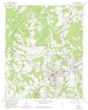
Batesburg Topo Map South Carolina
To zoom in, hover over the map of Batesburg
USGS Topo Quad 33081h5 - 1:24,000 scale
| Topo Map Name: | Batesburg |
| USGS Topo Quad ID: | 33081h5 |
| Print Size: | ca. 21 1/4" wide x 27" high |
| Southeast Coordinates: | 33.875° N latitude / 81.5° W longitude |
| Map Center Coordinates: | 33.9375° N latitude / 81.5625° W longitude |
| U.S. State: | SC |
| Filename: | o33081h5.jpg |
| Download Map JPG Image: | Batesburg topo map 1:24,000 scale |
| Map Type: | Topographic |
| Topo Series: | 7.5´ |
| Map Scale: | 1:24,000 |
| Source of Map Images: | United States Geological Survey (USGS) |
| Alternate Map Versions: |
Batesburg SC 1964, updated 1965 Download PDF Buy paper map Batesburg SC 1964, updated 1982 Download PDF Buy paper map Batesburg SC 2011 Download PDF Buy paper map Batesburg SC 2014 Download PDF Buy paper map |
1:24,000 Topo Quads surrounding Batesburg
> Back to 33081e1 at 1:100,000 scale
> Back to 33080a1 at 1:250,000 scale
> Back to U.S. Topo Maps home
Batesburg topo map: Gazetteer
Batesburg: Dams
Fricks Pond Dam D-0842 elevation 181m 593′J A Holmes Pond Dam D-1199 elevation 180m 590′
Ponderosos Pond Dam D-1154 elevation 146m 479′
South Carolina Noname 32065 D-0930 Dam elevation 190m 623′
South Carolina Noname 32099 D-0931 Dam elevation 172m 564′
South Carolina Noname 32105 D-1042 Dam elevation 146m 479′
South Carolina Noname 41004 D-1195 Dam elevation 162m 531′
Wises Pond Dam D-1604 elevation 161m 528′
Batesburg: Parks
Batesburg Commercial Historic District elevation 197m 646′Church Street Historic District elevation 200m 656′
Leesville College Historic District elevation 200m 656′
Batesburg: Populated Places
Batesburg elevation 196m 643′Batesburg-Leesville elevation 196m 643′
Hibernia elevation 196m 643′
Holston Crossroads elevation 168m 551′
Leesville elevation 200m 656′
Batesburg: Reservoirs
Batesburg Reservoir elevation 171m 561′Fricks Pond elevation 181m 593′
J A Holmes Pond elevation 180m 590′
Ponderosos Pond elevation 146m 479′
Wises Pond elevation 161m 528′
Batesburg: Streams
Bates Branch elevation 139m 456′Dye Creek elevation 140m 459′
Flat Rock Branch elevation 121m 396′
Gin Branch elevation 131m 429′
Harris Branch elevation 123m 403′
Lick Creek elevation 120m 393′
Mack Branch elevation 121m 396′
Moores Creek elevation 124m 406′
Warren Branch elevation 122m 400′
Batesburg digital topo map on disk
Buy this Batesburg topo map showing relief, roads, GPS coordinates and other geographical features, as a high-resolution digital map file on DVD:
South Carolina, Western North Carolina & Northeastern Georgia
Buy digital topo maps: South Carolina, Western North Carolina & Northeastern Georgia


