Gough Topo Map Georgia
To zoom in, hover over the map of Gough
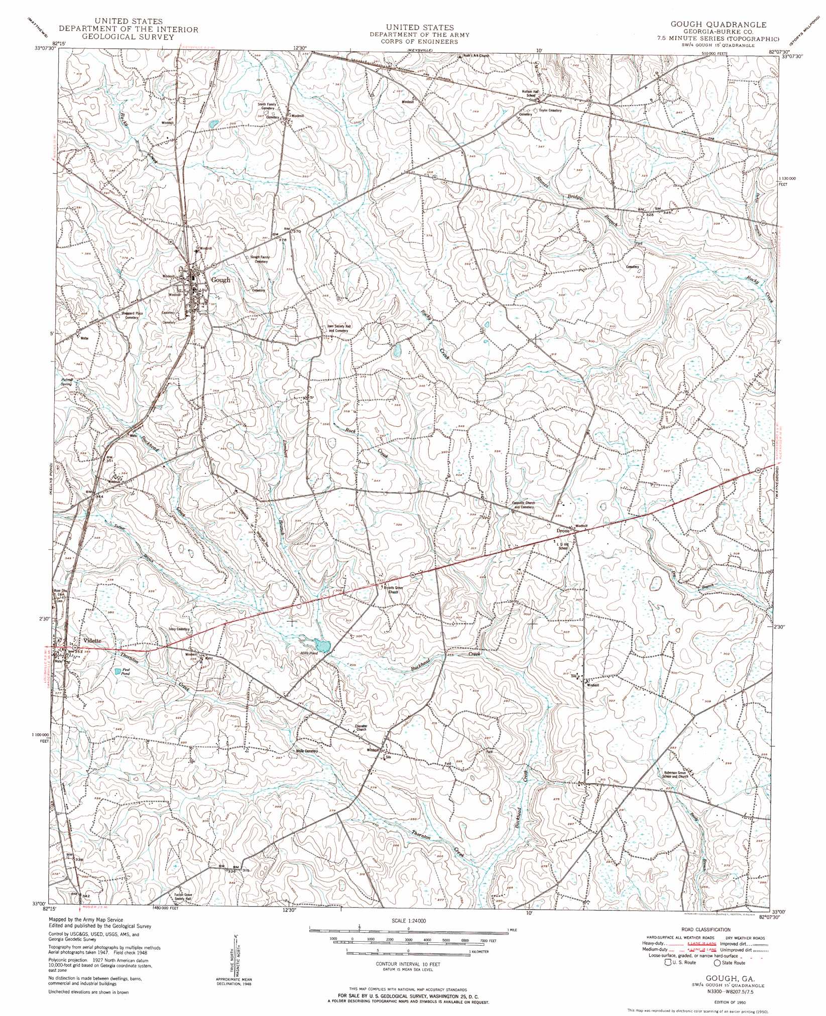
USGS Topo Quad 33082a2 - 1:24,000 scale
| Topo Map Name: | Gough |
| USGS Topo Quad ID: | 33082a2 |
| Print Size: | ca. 21 1/4" wide x 27" high |
| Southeast Coordinates: | 33° N latitude / 82.125° W longitude |
| Map Center Coordinates: | 33.0625° N latitude / 82.1875° W longitude |
| U.S. State: | GA |
| Filename: | o33082a2.jpg |
| Download Map JPG Image: | Gough topo map 1:24,000 scale |
| Map Type: | Topographic |
| Topo Series: | 7.5´ |
| Map Scale: | 1:24,000 |
| Source of Map Images: | United States Geological Survey (USGS) |
| Alternate Map Versions: |
Gough GA 1950 Download PDF Buy paper map Gough GA 1950 Download PDF Buy paper map Gough GA 2011 Download PDF Buy paper map Gough GA 2014 Download PDF Buy paper map |
1:24,000 Topo Quads surrounding Gough
Bowdens Pond |
Avondale |
Blythe |
Hephzibah |
Mechanic Hill |
Wrens |
Matthews |
Keysville |
Storys Millpond |
Mcbean |
Louisville |
Kellys Pond |
Gough |
Waynesboro |
Idlewood |
Louisville South |
Old Town |
Scotts Corner |
Bellevue |
Perkins |
Wadley |
Colemans Lake |
Midville |
Birdsville |
Millen |
> Back to 33082a1 at 1:100,000 scale
> Back to 33082a1 at 1:250,000 scale
> Back to U.S. Topo Maps home
Gough topo map: Gazetteer
Gough: Populated Places
Drone elevation 101m 331′Gough elevation 122m 400′
Vidette elevation 107m 351′
Gough: Post Offices
Gough Post Office elevation 122m 400′Gough: Reservoirs
Hills Pond elevation 82m 269′Peel Pond elevation 99m 324′
Gough: Springs
Palmer Spring elevation 104m 341′Gough: Streams
Dukes Branch elevation 79m 259′Lambert Branch elevation 81m 265′
Reubens Branch elevation 79m 259′
Rock Creek elevation 73m 239′
Thornton Creek elevation 69m 226′
Turner Branch elevation 84m 275′
Gough digital topo map on disk
Buy this Gough topo map showing relief, roads, GPS coordinates and other geographical features, as a high-resolution digital map file on DVD:
South Carolina, Western North Carolina & Northeastern Georgia
Buy digital topo maps: South Carolina, Western North Carolina & Northeastern Georgia