Matthews Topo Map Georgia
To zoom in, hover over the map of Matthews
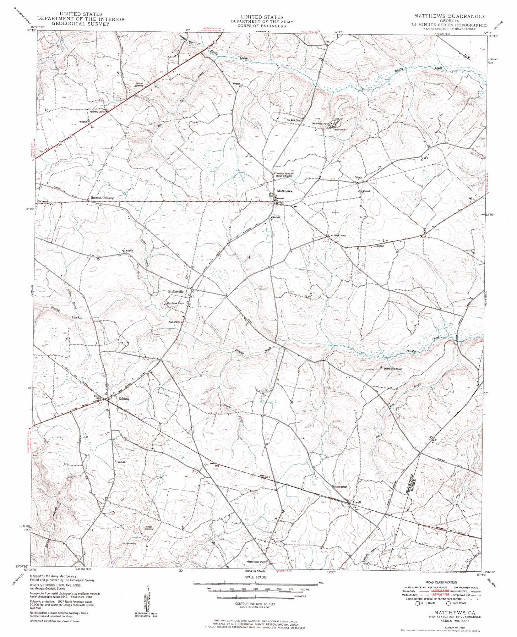
USGS Topo Quad 33082b3 - 1:24,000 scale
| Topo Map Name: | Matthews |
| USGS Topo Quad ID: | 33082b3 |
| Print Size: | ca. 21 1/4" wide x 27" high |
| Southeast Coordinates: | 33.125° N latitude / 82.25° W longitude |
| Map Center Coordinates: | 33.1875° N latitude / 82.3125° W longitude |
| U.S. State: | GA |
| Filename: | o33082b3.jpg |
| Download Map JPG Image: | Matthews topo map 1:24,000 scale |
| Map Type: | Topographic |
| Topo Series: | 7.5´ |
| Map Scale: | 1:24,000 |
| Source of Map Images: | United States Geological Survey (USGS) |
| Alternate Map Versions: |
Matthews GA 1950 Download PDF Buy paper map Matthews GA 1950 Download PDF Buy paper map Matthews GA 2011 Download PDF Buy paper map Matthews GA 2014 Download PDF Buy paper map |
1:24,000 Topo Quads surrounding Matthews
Thomson West |
Thompson East |
Harlem |
Grovetown |
Augusta West |
Bastonville |
Bowdens Pond |
Avondale |
Blythe |
Hephzibah |
Gibson |
Wrens |
Matthews |
Keysville |
Storys Millpond |
Grange |
Louisville |
Kellys Pond |
Gough |
Waynesboro |
Davisboro |
Louisville South |
Old Town |
Scotts Corner |
Bellevue |
> Back to 33082a1 at 1:100,000 scale
> Back to 33082a1 at 1:250,000 scale
> Back to U.S. Topo Maps home
Matthews topo map: Gazetteer
Matthews: Airports
Eliott Barrow Airport elevation 119m 390′Matthews: Bridges
Littles Bridge elevation 88m 288′Ways Bridge elevation 94m 308′
Matthews: Dams
Pennington Lake Dam elevation 105m 344′Pilcher Lake Dam elevation 101m 331′
Matthews: Populated Places
Atwell elevation 123m 403′Brinson Crossing elevation 124m 406′
Matthews elevation 119m 390′
Noah elevation 119m 390′
Padgett Crossing (historical) elevation 119m 390′
Stellaville elevation 114m 374′
Zebina elevation 122m 400′
Matthews: Reservoirs
Goodins Pond (historical) elevation 88m 288′Oliphant Pond (historical) elevation 93m 305′
Pennington Lake elevation 105m 344′
Pilcher Lake elevation 101m 331′
Matthews: Streams
Bull Nose Branch elevation 78m 255′Flat Rock Branch elevation 88m 288′
Hadden Branch elevation 99m 324′
Johnson Branch elevation 90m 295′
Jordan Branch elevation 95m 311′
Nortons Millrace elevation 88m 288′
Matthews: Swamps
Gun Pond elevation 118m 387′Matthews digital topo map on disk
Buy this Matthews topo map showing relief, roads, GPS coordinates and other geographical features, as a high-resolution digital map file on DVD:
South Carolina, Western North Carolina & Northeastern Georgia
Buy digital topo maps: South Carolina, Western North Carolina & Northeastern Georgia