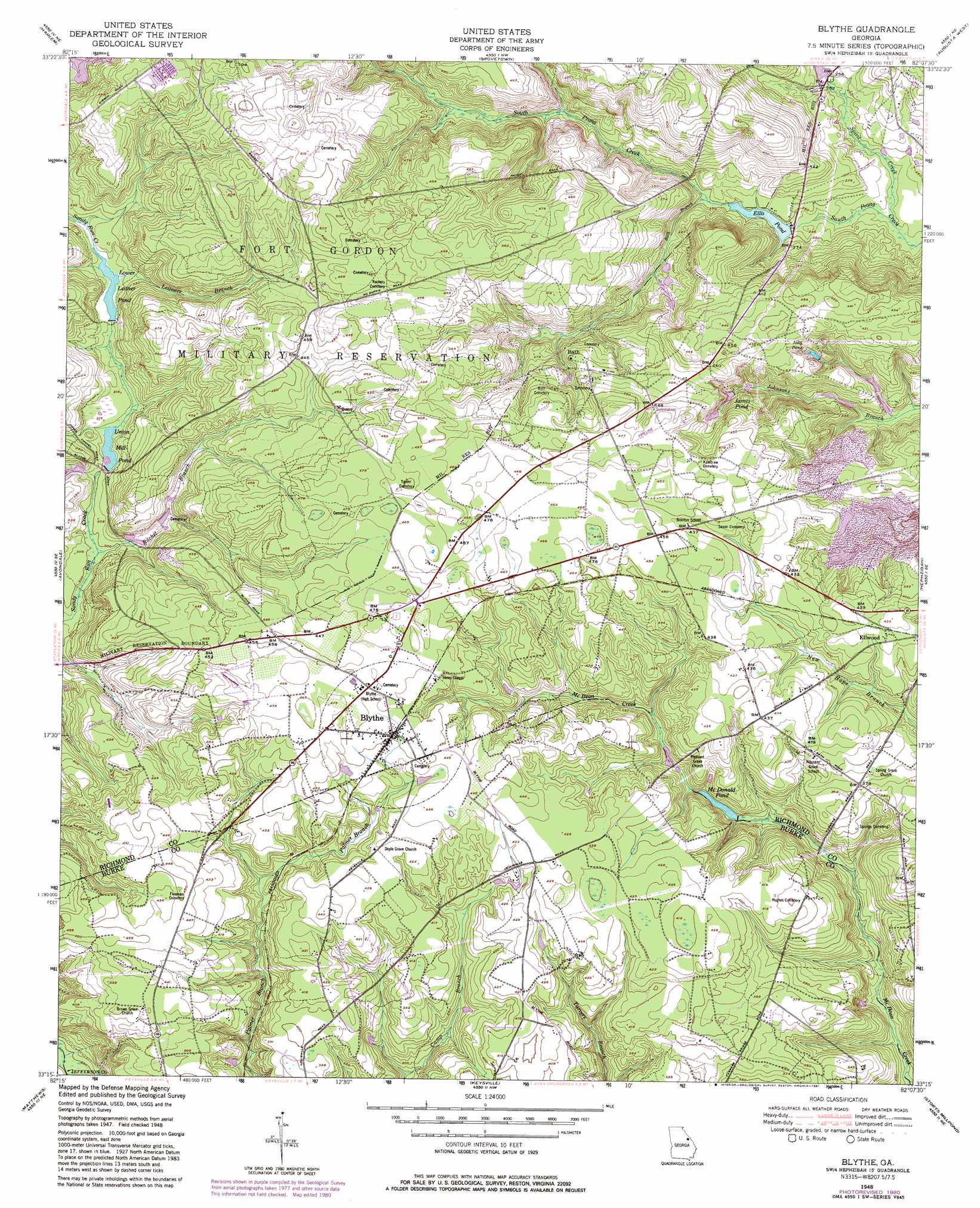
Blythe Topo Map Georgia
To zoom in, hover over the map of Blythe
USGS Topo Quad 33082c2 - 1:24,000 scale
| Topo Map Name: | Blythe |
| USGS Topo Quad ID: | 33082c2 |
| Print Size: | ca. 21 1/4" wide x 27" high |
| Southeast Coordinates: | 33.25° N latitude / 82.125° W longitude |
| Map Center Coordinates: | 33.3125° N latitude / 82.1875° W longitude |
| U.S. State: | GA |
| Filename: | o33082c2.jpg |
| Download Map JPG Image: | Blythe topo map 1:24,000 scale |
| Map Type: | Topographic |
| Topo Series: | 7.5´ |
| Map Scale: | 1:24,000 |
| Source of Map Images: | United States Geological Survey (USGS) |
| Alternate Map Versions: |
Blythe GA 1948, updated 1964 Download PDF Buy paper map Blythe GA 1948, updated 1972 Download PDF Buy paper map Blythe GA 1948, updated 1973 Download PDF Buy paper map Blythe GA 1948, updated 1981 Download PDF Buy paper map Blythe GA 1953 Download PDF Buy paper map Blythe GA 2011 Download PDF Buy paper map Blythe GA 2014 Download PDF Buy paper map |
1:24,000 Topo Quads surrounding Blythe
Winfield |
Appling |
Evans |
Martinez |
North Augusta |
Thompson East |
Harlem |
Grovetown |
Augusta West |
Augusta East |
Bowdens Pond |
Avondale |
Blythe |
Hephzibah |
Mechanic Hill |
Wrens |
Matthews |
Keysville |
Storys Millpond |
Mcbean |
Louisville |
Kellys Pond |
Gough |
Waynesboro |
Idlewood |
> Back to 33082a1 at 1:100,000 scale
> Back to 33082a1 at 1:250,000 scale
> Back to U.S. Topo Maps home
Blythe topo map: Gazetteer
Blythe: Airports
Pea Patch Aerodrome elevation 133m 436′Teal Airpark elevation 141m 462′
Blythe: Dams
Ellis Pond Dam elevation 73m 239′Gordon Lakes Dam elevation 78m 255′
Lake Inez Dam elevation 110m 360′
Blythe: Populated Places
Bath elevation 119m 390′Blythe elevation 137m 449′
Edie (historical) elevation 132m 433′
Ellwood elevation 128m 419′
Blythe: Reservoirs
Ellis Pond elevation 73m 239′Gordon Lake elevation 78m 255′
James Pond elevation 101m 331′
Jolly Pond elevation 99m 324′
Lower Leitner Pond elevation 97m 318′
McDonald Pond elevation 90m 295′
Union Mill Pond elevation 93m 305′
Blythe: Streams
Bath Branch elevation 75m 246′Leitners Branch elevation 100m 328′
Rachel Branch elevation 89m 291′
South Prong Creek elevation 69m 226′
Spirit Creek elevation 69m 226′
Blythe digital topo map on disk
Buy this Blythe topo map showing relief, roads, GPS coordinates and other geographical features, as a high-resolution digital map file on DVD:
South Carolina, Western North Carolina & Northeastern Georgia
Buy digital topo maps: South Carolina, Western North Carolina & Northeastern Georgia