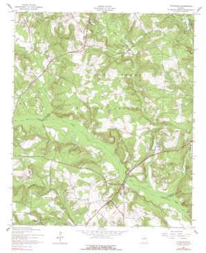
Avondale Topo Map Georgia
To zoom in, hover over the map of Avondale
USGS Topo Quad 33082c3 - 1:24,000 scale
| Topo Map Name: | Avondale |
| USGS Topo Quad ID: | 33082c3 |
| Print Size: | ca. 21 1/4" wide x 27" high |
| Southeast Coordinates: | 33.25° N latitude / 82.25° W longitude |
| Map Center Coordinates: | 33.3125° N latitude / 82.3125° W longitude |
| U.S. State: | GA |
| Filename: | o33082c3.jpg |
| Download Map JPG Image: | Avondale topo map 1:24,000 scale |
| Map Type: | Topographic |
| Topo Series: | 7.5´ |
| Map Scale: | 1:24,000 |
| Source of Map Images: | United States Geological Survey (USGS) |
| Alternate Map Versions: |
Avondale GA 1950 Download PDF Buy paper map Avondale GA 1957, updated 1960 Download PDF Buy paper map Avondale GA 1957, updated 1978 Download PDF Buy paper map Avondale GA 1957, updated 1991 Download PDF Buy paper map Avondale GA 2011 Download PDF Buy paper map Avondale GA 2014 Download PDF Buy paper map |
1:24,000 Topo Quads surrounding Avondale
> Back to 33082a1 at 1:100,000 scale
> Back to 33082a1 at 1:250,000 scale
> Back to U.S. Topo Maps home
Avondale topo map: Gazetteer
Avondale: Bridges
Patterson Bridge elevation 80m 262′Avondale: Dams
Euclid Claussen Pond Dam elevation 84m 275′George Claussen Pond Dam elevation 84m 275′
Avondale: Populated Places
Avondale elevation 154m 505′Avondale: Reservoirs
Burch Mill Pond (historical) elevation 103m 337′Euclid Claussen Pond elevation 84m 275′
George Claussen Pond elevation 84m 275′
James Pond elevation 96m 314′
Lake Inez elevation 92m 301′
Leitner Pond elevation 104m 341′
Avondale: Streams
Boggy Gut Creek elevation 78m 255′Hard Fortune Creek elevation 90m 295′
Headstall Creek elevation 85m 278′
Little Sandy Run Creek elevation 105m 344′
Sandy Run Creek elevation 77m 252′
Avondale digital topo map on disk
Buy this Avondale topo map showing relief, roads, GPS coordinates and other geographical features, as a high-resolution digital map file on DVD:
South Carolina, Western North Carolina & Northeastern Georgia
Buy digital topo maps: South Carolina, Western North Carolina & Northeastern Georgia


