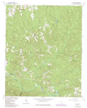
Colliers Topo Map South Carolina
To zoom in, hover over the map of Colliers
USGS Topo Quad 33082f1 - 1:24,000 scale
| Topo Map Name: | Colliers |
| USGS Topo Quad ID: | 33082f1 |
| Print Size: | ca. 21 1/4" wide x 27" high |
| Southeast Coordinates: | 33.625° N latitude / 82° W longitude |
| Map Center Coordinates: | 33.6875° N latitude / 82.0625° W longitude |
| U.S. State: | SC |
| Filename: | o33082f1.jpg |
| Download Map JPG Image: | Colliers topo map 1:24,000 scale |
| Map Type: | Topographic |
| Topo Series: | 7.5´ |
| Map Scale: | 1:24,000 |
| Source of Map Images: | United States Geological Survey (USGS) |
| Alternate Map Versions: |
Colliers SC 1964, updated 1966 Download PDF Buy paper map Colliers SC 1964, updated 1986 Download PDF Buy paper map Colliers SC 2011 Download PDF Buy paper map Colliers SC 2014 Download PDF Buy paper map |
| FStopo: | US Forest Service topo Colliers is available: Download FStopo PDF Download FStopo TIF |
1:24,000 Topo Quads surrounding Colliers
> Back to 33082e1 at 1:100,000 scale
> Back to 33082a1 at 1:250,000 scale
> Back to U.S. Topo Maps home
Colliers topo map: Gazetteer
Colliers: Dams
Lick Fork Lake Dam D-0875 elevation 106m 347′Wall Pond Dam D-1691 elevation 76m 249′
Colliers: Populated Places
Colliers elevation 129m 423′Millers Crossroads elevation 139m 456′
Colliers: Reservoirs
Lick Fork Lake elevation 106m 347′Colliers: Streams
Big Branch elevation 58m 190′Big Branch elevation 73m 239′
Big Creek elevation 60m 196′
Cedar Creek elevation 77m 252′
Cheves Creek elevation 58m 190′
Dry Branch elevation 58m 190′
Dry Creek elevation 65m 213′
Horn Creek elevation 104m 341′
Lick Fork elevation 65m 213′
Miller Branch elevation 85m 278′
Owl Branch elevation 91m 298′
Reedy Branch elevation 56m 183′
Rock Creek elevation 72m 236′
Williams Branch elevation 59m 193′
Colliers: Summits
Carey Hill elevation 120m 393′Colliers: Trails
Horn Creek Hiking Trail elevation 77m 252′Colliers digital topo map on disk
Buy this Colliers topo map showing relief, roads, GPS coordinates and other geographical features, as a high-resolution digital map file on DVD:
South Carolina, Western North Carolina & Northeastern Georgia
Buy digital topo maps: South Carolina, Western North Carolina & Northeastern Georgia


