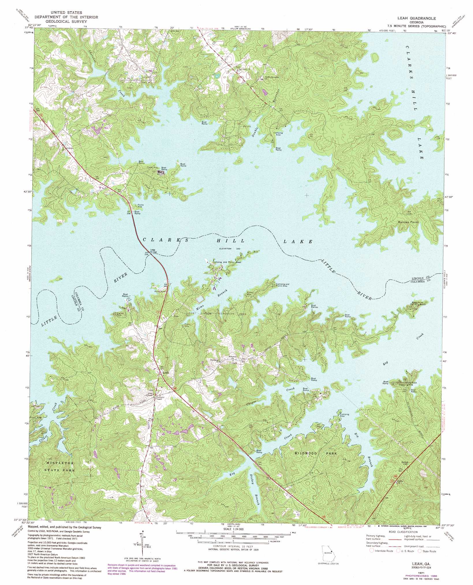
Leah Topo Map Georgia
To zoom in, hover over the map of Leah
USGS Topo Quad 33082f3 - 1:24,000 scale
| Topo Map Name: | Leah |
| USGS Topo Quad ID: | 33082f3 |
| Print Size: | ca. 21 1/4" wide x 27" high |
| Southeast Coordinates: | 33.625° N latitude / 82.25° W longitude |
| Map Center Coordinates: | 33.6875° N latitude / 82.3125° W longitude |
| U.S. State: | GA |
| Filename: | o33082f3.jpg |
| Download Map JPG Image: | Leah topo map 1:24,000 scale |
| Map Type: | Topographic |
| Topo Series: | 7.5´ |
| Map Scale: | 1:24,000 |
| Source of Map Images: | United States Geological Survey (USGS) |
| Alternate Map Versions: |
Leah GA 1971, updated 1973 Download PDF Buy paper map Leah GA 1971, updated 1987 Download PDF Buy paper map Leah GA 2011 Download PDF Buy paper map Leah GA 2014 Download PDF Buy paper map |
1:24,000 Topo Quads surrounding Leah
Chennault |
Willington |
Mccormick |
Winterseat |
Limestone |
Metasville |
Lincolnton |
Plum Branch |
Parksville |
Red Hill |
Aonia |
Woodlawn |
Leah |
Clarks Hill |
Colliers |
Wrightsboro |
Winfield |
Appling |
Evans |
Martinez |
Thomson West |
Thompson East |
Harlem |
Grovetown |
Augusta West |
> Back to 33082e1 at 1:100,000 scale
> Back to 33082a1 at 1:250,000 scale
> Back to U.S. Topo Maps home
Leah topo map: Gazetteer
Leah: Bridges
Legg Bridge elevation 100m 328′Leah: Capes
Bussey Point elevation 116m 380′Leah: Crossings
Lockhart Ferry (historical) elevation 100m 328′McCord Ferry (historical) elevation 100m 328′
Price Ferry (historical) elevation 100m 328′
Leah: Dams
Eubank Lake Dam elevation 108m 354′Leah: Islands
Price Island (historical) elevation 100m 328′Leah: Parks
Fort Gordon Recreation Area elevation 116m 380′Keg Creek State Park elevation 120m 393′
Mistletoe State Park elevation 120m 393′
Leah: Populated Places
Bussey elevation 136m 446′Dunn Chapel elevation 151m 495′
Eubank (historical) elevation 101m 331′
Leah elevation 134m 439′
Leah: Reservoirs
Eubank Lake elevation 108m 354′Leah: Streams
Big Branch elevation 100m 328′Canidy Branch elevation 100m 328′
Cherokee Creek elevation 100m 328′
Chigoe Creek elevation 100m 328′
Cliatt Creek elevation 100m 328′
Dickey Branch elevation 100m 328′
Double Branches elevation 100m 328′
Mims Branch elevation 100m 328′
Leah digital topo map on disk
Buy this Leah topo map showing relief, roads, GPS coordinates and other geographical features, as a high-resolution digital map file on DVD:
South Carolina, Western North Carolina & Northeastern Georgia
Buy digital topo maps: South Carolina, Western North Carolina & Northeastern Georgia