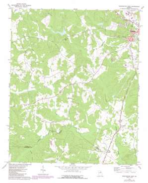
Washington West Topo Map Georgia
To zoom in, hover over the map of Washington West
USGS Topo Quad 33082f7 - 1:24,000 scale
| Topo Map Name: | Washington West |
| USGS Topo Quad ID: | 33082f7 |
| Print Size: | ca. 21 1/4" wide x 27" high |
| Southeast Coordinates: | 33.625° N latitude / 82.75° W longitude |
| Map Center Coordinates: | 33.6875° N latitude / 82.8125° W longitude |
| U.S. State: | GA |
| Filename: | o33082f7.jpg |
| Download Map JPG Image: | Washington West topo map 1:24,000 scale |
| Map Type: | Topographic |
| Topo Series: | 7.5´ |
| Map Scale: | 1:24,000 |
| Source of Map Images: | United States Geological Survey (USGS) |
| Alternate Map Versions: |
Washington West GA 1972, updated 1975 Download PDF Buy paper map Washington West GA 2011 Download PDF Buy paper map Washington West GA 2014 Download PDF Buy paper map |
1:24,000 Topo Quads surrounding Washington West
> Back to 33082e1 at 1:100,000 scale
> Back to 33082a1 at 1:250,000 scale
> Back to U.S. Topo Maps home
Washington West topo map: Gazetteer
Washington West: Dams
Beaverdam Creek Dam elevation 143m 469′Burdette-Harris Dam Number One elevation 146m 479′
City of Washington Reservoir Dam elevation 141m 462′
Edwards Lake Dam elevation 147m 482′
Harris-Burdette Dam Two elevation 154m 505′
Palmer Lake Dam elevation 131m 429′
Washington West: Mines
Stony Ridge Mine elevation 177m 580′Washington West: Parks
Ranger Stadium elevation 188m 616′Washington West: Populated Places
Ficklin elevation 132m 433′Lina (historical) elevation 175m 574′
Lincoln Heights elevation 166m 544′
Little River elevation 122m 400′
Tyrone elevation 173m 567′
Washington Heights elevation 178m 583′
Washington West: Reservoirs
Beaverdam Creek Lake elevation 143m 469′Burdette-Harris Lake Number One elevation 146m 479′
City of Washington Reservoir elevation 141m 462′
Edwards Lake elevation 147m 482′
Harris-Burdette Lake Two elevation 154m 505′
Palmer Lake elevation 131m 429′
Washington West: Streams
Beaverdam Creek elevation 119m 390′Harden Creek elevation 113m 370′
Kettle Creek elevation 121m 396′
Little Beaverdam Creek elevation 128m 419′
Little Kettle Creek elevation 126m 413′
Powder Creek elevation 126m 413′
Washington West digital topo map on disk
Buy this Washington West topo map showing relief, roads, GPS coordinates and other geographical features, as a high-resolution digital map file on DVD:
South Carolina, Western North Carolina & Northeastern Georgia
Buy digital topo maps: South Carolina, Western North Carolina & Northeastern Georgia


