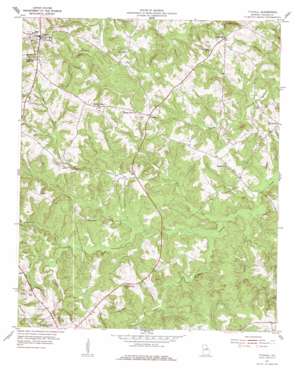
Tignall Topo Map Georgia
To zoom in, hover over the map of Tignall
USGS Topo Quad 33082g6 - 1:24,000 scale
| Topo Map Name: | Tignall |
| USGS Topo Quad ID: | 33082g6 |
| Print Size: | ca. 21 1/4" wide x 27" high |
| Southeast Coordinates: | 33.75° N latitude / 82.625° W longitude |
| Map Center Coordinates: | 33.8125° N latitude / 82.6875° W longitude |
| U.S. State: | GA |
| Filename: | o33082g6.jpg |
| Download Map JPG Image: | Tignall topo map 1:24,000 scale |
| Map Type: | Topographic |
| Topo Series: | 7.5´ |
| Map Scale: | 1:24,000 |
| Source of Map Images: | United States Geological Survey (USGS) |
| Alternate Map Versions: |
Tignall GA 1955, updated 1956 Download PDF Buy paper map Tignall GA 1955, updated 1978 Download PDF Buy paper map Tignall GA 2011 Download PDF Buy paper map Tignall GA 2014 Download PDF Buy paper map |
1:24,000 Topo Quads surrounding Tignall
> Back to 33082e1 at 1:100,000 scale
> Back to 33082a1 at 1:250,000 scale
> Back to U.S. Topo Maps home
Tignall topo map: Gazetteer
Tignall: Dams
Garrard Dam elevation 143m 469′Norman Lake Dam elevation 144m 472′
Tignall: Populated Places
Cohentown elevation 162m 531′Danburg elevation 174m 570′
Floral Hill elevation 157m 515′
Possie (historical) elevation 135m 442′
Sandtown elevation 180m 590′
Sandy Hill elevation 183m 600′
Tignall elevation 197m 646′
Tignall: Reservoirs
Garrard Lake elevation 143m 469′Norman Lake elevation 144m 472′
Tignall: Streams
Anderson Mill Creek elevation 115m 377′Armstrong Branch elevation 126m 413′
Benson Branch elevation 112m 367′
Hog Fork elevation 124m 406′
Middle Creek elevation 125m 410′
Rock Creek elevation 128m 419′
Threemile Creek elevation 133m 436′
Wynn Creek elevation 117m 383′
Tignall digital topo map on disk
Buy this Tignall topo map showing relief, roads, GPS coordinates and other geographical features, as a high-resolution digital map file on DVD:
South Carolina, Western North Carolina & Northeastern Georgia
Buy digital topo maps: South Carolina, Western North Carolina & Northeastern Georgia


