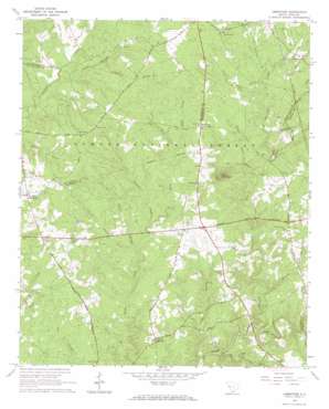
Limestone Topo Map South Carolina
To zoom in, hover over the map of Limestone
USGS Topo Quad 33082h1 - 1:24,000 scale
| Topo Map Name: | Limestone |
| USGS Topo Quad ID: | 33082h1 |
| Print Size: | ca. 21 1/4" wide x 27" high |
| Southeast Coordinates: | 33.875° N latitude / 82° W longitude |
| Map Center Coordinates: | 33.9375° N latitude / 82.0625° W longitude |
| U.S. State: | SC |
| Filename: | o33082h1.jpg |
| Download Map JPG Image: | Limestone topo map 1:24,000 scale |
| Map Type: | Topographic |
| Topo Series: | 7.5´ |
| Map Scale: | 1:24,000 |
| Source of Map Images: | United States Geological Survey (USGS) |
| Alternate Map Versions: |
Limestone SC 1965, updated 1967 Download PDF Buy paper map Limestone SC 2011 Download PDF Buy paper map Limestone SC 2014 Download PDF Buy paper map |
| FStopo: | US Forest Service topo Limestone is available: Download FStopo PDF Download FStopo TIF |
1:24,000 Topo Quads surrounding Limestone
> Back to 33082e1 at 1:100,000 scale
> Back to 33082a1 at 1:250,000 scale
> Back to U.S. Topo Maps home
Limestone topo map: Gazetteer
Limestone: Bridges
Double Bridge elevation 119m 390′Limestone: Populated Places
Lime Stone (historical) elevation 142m 465′Limestone elevation 129m 423′
Mayson Crossroads elevation 164m 538′
Pittsburg elevation 149m 488′
Sheppard Crossroads elevation 150m 492′
Sullivan Crossroads elevation 160m 524′
Limestone: Reservoirs
Corley Pond elevation 159m 521′Limestone: Streams
Bell Branch elevation 115m 377′Cartledge Branch elevation 116m 380′
Catholic Branch elevation 131m 429′
Hegwood Branch elevation 95m 311′
Jim Branch elevation 82m 269′
Little Horsepen Creek elevation 122m 400′
Little Mountain Creek elevation 118m 387′
Log Creek elevation 84m 275′
Mount Carmel Branch elevation 139m 456′
Mountain Creek elevation 88m 288′
Pickell Branch elevation 127m 416′
Quaker Branch elevation 121m 396′
Reedy Creek elevation 125m 410′
Stockman Branch elevation 121m 396′
Talbert Branch elevation 139m 456′
Wiley Branch elevation 131m 429′
Wilson Branch elevation 118m 387′
Limestone: Summits
Boles Mountain elevation 194m 636′Limestone digital topo map on disk
Buy this Limestone topo map showing relief, roads, GPS coordinates and other geographical features, as a high-resolution digital map file on DVD:
South Carolina, Western North Carolina & Northeastern Georgia
Buy digital topo maps: South Carolina, Western North Carolina & Northeastern Georgia


