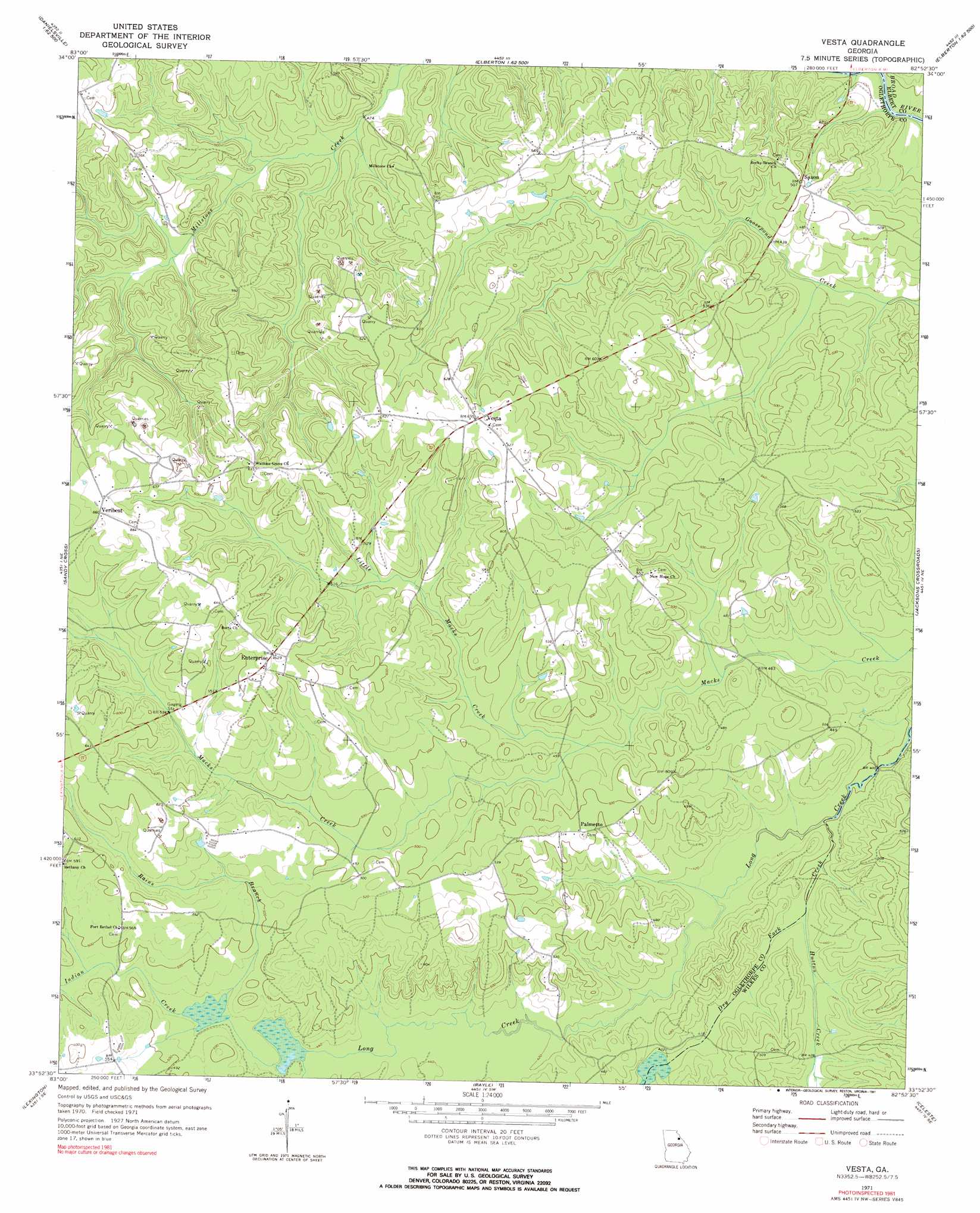
Vesta Topo Map Georgia
To zoom in, hover over the map of Vesta
USGS Topo Quad 33082h8 - 1:24,000 scale
| Topo Map Name: | Vesta |
| USGS Topo Quad ID: | 33082h8 |
| Print Size: | ca. 21 1/4" wide x 27" high |
| Southeast Coordinates: | 33.875° N latitude / 82.875° W longitude |
| Map Center Coordinates: | 33.9375° N latitude / 82.9375° W longitude |
| U.S. State: | GA |
| Filename: | o33082h8.jpg |
| Download Map JPG Image: | Vesta topo map 1:24,000 scale |
| Map Type: | Topographic |
| Topo Series: | 7.5´ |
| Map Scale: | 1:24,000 |
| Source of Map Images: | United States Geological Survey (USGS) |
| Alternate Map Versions: |
Vesta GA 1971, updated 1973 Download PDF Buy paper map Vesta GA 2011 Download PDF Buy paper map Vesta GA 2014 Download PDF Buy paper map |
1:24,000 Topo Quads surrounding Vesta
Danielsville North |
Bowman |
Dewy Rose |
Rock Branch |
Lowndesville |
Danielsville South |
Carlton |
Elberton West |
Elberton East |
Heardmont |
Crawford |
Sandy Cross |
Vesta |
Jacksons Crossroads |
Broad |
Maxeys |
Lexington |
Rayle |
Celeste |
Tignall |
Penfield |
Woodville |
Philomath |
Washington West |
Washington East |
> Back to 33082e1 at 1:100,000 scale
> Back to 33082a1 at 1:250,000 scale
> Back to U.S. Topo Maps home
Vesta topo map: Gazetteer
Vesta: Bridges
Barbers Bridge elevation 128m 419′Vesta: Populated Places
Enterprise elevation 195m 639′Fairview elevation 175m 574′
Palmetto elevation 158m 518′
Saxon elevation 153m 501′
Sycorax (historical) elevation 167m 547′
Veribest elevation 201m 659′
Vesta elevation 193m 633′
Vesta: Streams
Dry Fork Creek elevation 125m 410′Hutton Creek elevation 134m 439′
Indian Creek elevation 133m 436′
Little Macks Creek elevation 143m 469′
Rains Branch elevation 141m 462′
Vesta digital topo map on disk
Buy this Vesta topo map showing relief, roads, GPS coordinates and other geographical features, as a high-resolution digital map file on DVD:
South Carolina, Western North Carolina & Northeastern Georgia
Buy digital topo maps: South Carolina, Western North Carolina & Northeastern Georgia