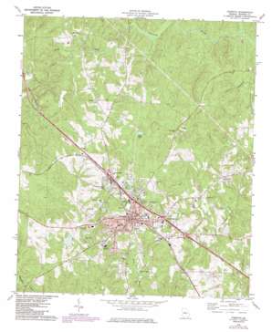
Forsyth Topo Map Georgia
To zoom in, hover over the map of Forsyth
USGS Topo Quad 33083a8 - 1:24,000 scale
| Topo Map Name: | Forsyth |
| USGS Topo Quad ID: | 33083a8 |
| Print Size: | ca. 21 1/4" wide x 27" high |
| Southeast Coordinates: | 33° N latitude / 83.875° W longitude |
| Map Center Coordinates: | 33.0625° N latitude / 83.9375° W longitude |
| U.S. State: | GA |
| Filename: | o33083a8.jpg |
| Download Map JPG Image: | Forsyth topo map 1:24,000 scale |
| Map Type: | Topographic |
| Topo Series: | 7.5´ |
| Map Scale: | 1:24,000 |
| Source of Map Images: | United States Geological Survey (USGS) |
| Alternate Map Versions: |
Forsyth GA 1973, updated 1976 Download PDF Buy paper map Forsyth GA 1973, updated 1985 Download PDF Buy paper map Forsyth GA 2011 Download PDF Buy paper map Forsyth GA 2014 Download PDF Buy paper map |
1:24,000 Topo Quads surrounding Forsyth
> Back to 33083a1 at 1:100,000 scale
> Back to 33082a1 at 1:250,000 scale
> Back to U.S. Topo Maps home
Forsyth topo map: Gazetteer
Forsyth: Airports
Monroe County Hospital Heliport elevation 197m 646′Forsyth: Crossings
Exit 60 elevation 200m 656′Exit 61 elevation 205m 672′
Exit 62 elevation 195m 639′
Exit 63 elevation 214m 702′
Forsyth: Dams
Millwood Lake Dam elevation 149m 488′Pace Lake Dam elevation 157m 515′
Persons Lake Dam elevation 172m 564′
Forsyth: Lakes
Hook Pond elevation 169m 554′Forsyth: Parks
Forsyth Commercial Historic District elevation 219m 718′Forsyth: Populated Places
Box Ankle elevation 175m 574′Brighton Heights elevation 214m 702′
Brighton Mills elevation 212m 695′
Forsyth elevation 220m 721′
Logwall elevation 158m 518′
Maynard elevation 190m 623′
Star Mills elevation 205m 672′
Forsyth: Post Offices
Forsyth Post Office elevation 216m 708′Forsyth: Reservoirs
Millwood Lake elevation 149m 488′Pace Lake elevation 157m 515′
Persons Lake elevation 172m 564′
Forsyth: Streams
Cooks Creek elevation 148m 485′Red Creek elevation 152m 498′
Rocky Creek elevation 127m 416′
Town Creek elevation 140m 459′
White Creek elevation 163m 534′
Forsyth digital topo map on disk
Buy this Forsyth topo map showing relief, roads, GPS coordinates and other geographical features, as a high-resolution digital map file on DVD:
South Carolina, Western North Carolina & Northeastern Georgia
Buy digital topo maps: South Carolina, Western North Carolina & Northeastern Georgia


