Eatonton Topo Map Georgia
To zoom in, hover over the map of Eatonton
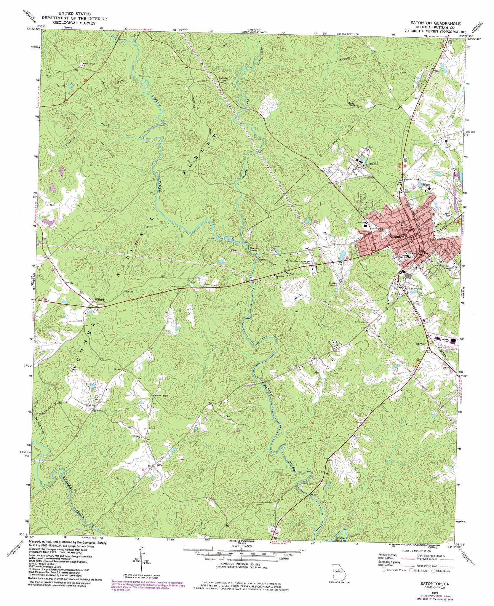
USGS Topo Quad 33083c4 - 1:24,000 scale
| Topo Map Name: | Eatonton |
| USGS Topo Quad ID: | 33083c4 |
| Print Size: | ca. 21 1/4" wide x 27" high |
| Southeast Coordinates: | 33.25° N latitude / 83.375° W longitude |
| Map Center Coordinates: | 33.3125° N latitude / 83.4375° W longitude |
| U.S. State: | GA |
| Filename: | o33083c4.jpg |
| Download Map JPG Image: | Eatonton topo map 1:24,000 scale |
| Map Type: | Topographic |
| Topo Series: | 7.5´ |
| Map Scale: | 1:24,000 |
| Source of Map Images: | United States Geological Survey (USGS) |
| Alternate Map Versions: |
Eatonton GA 1972, updated 1974 Download PDF Buy paper map Eatonton GA 1972, updated 1986 Download PDF Buy paper map Eatonton GA 2011 Download PDF Buy paper map Eatonton GA 2014 Download PDF Buy paper map |
| FStopo: | US Forest Service topo Eatonton is available: Download FStopo PDF Download FStopo TIF |
1:24,000 Topo Quads surrounding Eatonton
Mansfield |
Rutledge South |
Madison |
Buckhead |
Greensboro |
Farrar |
Shady Dale |
Rock Eagle Lake |
Harmony |
Liberty |
Monticello |
Smithboro |
Eatonton |
Meda |
Rockville |
Hillsboro |
Stanfordville |
Resseaus Crossroads |
Lake Sinclair West |
Lake Sinclair East |
Dames Ferry |
Gray |
Haddock |
Browns Crossing |
Milledgeville |
> Back to 33083a1 at 1:100,000 scale
> Back to 33082a1 at 1:250,000 scale
> Back to U.S. Topo Maps home
Eatonton topo map: Gazetteer
Eatonton: Dams
Rooty Creek Structure Number 21 Dam elevation 146m 479′Eatonton: Parks
Adiel Sherwood Monument elevation 179m 587′Eatonton Historic District elevation 172m 564′
Eatonton: Populated Places
Eatonton elevation 172m 564′Glenwoods Spring (historical) elevation 172m 564′
Hunts elevation 173m 567′
Huron (historical) elevation 118m 387′
Imperial elevation 159m 521′
Linchburg elevation 158m 518′
Note elevation 176m 577′
Warfield elevation 177m 580′
Willard elevation 169m 554′
Eatonton: Post Offices
Eatonton Post Office elevation 172m 564′Eatonton: Reservoirs
Rooty Creek Structure Number 21 Lake elevation 146m 479′Eatonton: Streams
Beaverdam Creek elevation 121m 396′Big Indian Creek elevation 124m 406′
Blue Branch elevation 108m 354′
Glady Creek elevation 116m 380′
Little Glady Creek elevation 128m 419′
Pearson Creek elevation 121m 396′
Reece Branch elevation 107m 351′
Eatonton digital topo map on disk
Buy this Eatonton topo map showing relief, roads, GPS coordinates and other geographical features, as a high-resolution digital map file on DVD:
South Carolina, Western North Carolina & Northeastern Georgia
Buy digital topo maps: South Carolina, Western North Carolina & Northeastern Georgia