White Plains Topo Map Georgia
To zoom in, hover over the map of White Plains
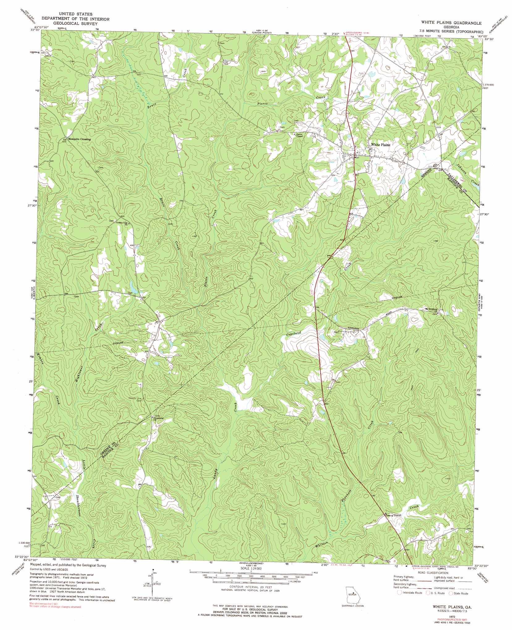
USGS Topo Quad 33083d1 - 1:24,000 scale
| Topo Map Name: | White Plains |
| USGS Topo Quad ID: | 33083d1 |
| Print Size: | ca. 21 1/4" wide x 27" high |
| Southeast Coordinates: | 33.375° N latitude / 83° W longitude |
| Map Center Coordinates: | 33.4375° N latitude / 83.0625° W longitude |
| U.S. State: | GA |
| Filename: | o33083d1.jpg |
| Download Map JPG Image: | White Plains topo map 1:24,000 scale |
| Map Type: | Topographic |
| Topo Series: | 7.5´ |
| Map Scale: | 1:24,000 |
| Source of Map Images: | United States Geological Survey (USGS) |
| Alternate Map Versions: |
White Plains GA 1972, updated 1975 Download PDF Buy paper map White Plains GA 2011 Download PDF Buy paper map White Plains GA 2014 Download PDF Buy paper map |
1:24,000 Topo Quads surrounding White Plains
Greshamville |
Penfield |
Woodville |
Philomath |
Washington West |
Buckhead |
Greensboro |
Union Point |
Crawfordville |
Sharon |
Harmony |
Liberty |
White Plains |
Sparta Nw |
Sparta Ne |
Meda |
Rockville |
Shoulderbone |
Sparta |
Jewell |
Lake Sinclair West |
Lake Sinclair East |
Devereux |
Warthen Nw |
Warthen Ne |
> Back to 33083a1 at 1:100,000 scale
> Back to 33082a1 at 1:250,000 scale
> Back to U.S. Topo Maps home
White Plains topo map: Gazetteer
White Plains: Areas
Big House Field elevation 202m 662′White Plains: Populated Places
Gum Hill elevation 180m 590′Mosquito Crossing elevation 190m 623′
Swaggy Valley elevation 183m 600′
White Plains elevation 211m 692′
White Plains: Post Offices
White Plains Post Office elevation 212m 695′White Plains: Reservoirs
The Blue Hole elevation 197m 646′White Plains: Streams
Bruce Creek elevation 140m 459′Copeland Creek elevation 128m 419′
Hightower Creek elevation 134m 439′
Kimbro Creek elevation 134m 439′
Pierce Creek elevation 140m 459′
Plunkett Creek elevation 122m 400′
White Plains digital topo map on disk
Buy this White Plains topo map showing relief, roads, GPS coordinates and other geographical features, as a high-resolution digital map file on DVD:
South Carolina, Western North Carolina & Northeastern Georgia
Buy digital topo maps: South Carolina, Western North Carolina & Northeastern Georgia