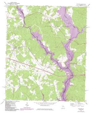
Buckhead Topo Map Georgia
To zoom in, hover over the map of Buckhead
USGS Topo Quad 33083e3 - 1:24,000 scale
| Topo Map Name: | Buckhead |
| USGS Topo Quad ID: | 33083e3 |
| Print Size: | ca. 21 1/4" wide x 27" high |
| Southeast Coordinates: | 33.5° N latitude / 83.25° W longitude |
| Map Center Coordinates: | 33.5625° N latitude / 83.3125° W longitude |
| U.S. State: | GA |
| Filename: | o33083e3.jpg |
| Download Map JPG Image: | Buckhead topo map 1:24,000 scale |
| Map Type: | Topographic |
| Topo Series: | 7.5´ |
| Map Scale: | 1:24,000 |
| Source of Map Images: | United States Geological Survey (USGS) |
| Alternate Map Versions: |
Buckhead GA 1972, updated 1974 Download PDF Buy paper map Buckhead GA 1972, updated 1986 Download PDF Buy paper map Buckhead GA 2011 Download PDF Buy paper map Buckhead GA 2014 Download PDF Buy paper map |
| FStopo: | US Forest Service topo Buckhead is available: Download FStopo PDF Download FStopo TIF |
1:24,000 Topo Quads surrounding Buckhead
> Back to 33083e1 at 1:100,000 scale
> Back to 33082a1 at 1:250,000 scale
> Back to U.S. Topo Maps home
Buckhead topo map: Gazetteer
Buckhead: Crossings
Exit 52 elevation 170m 557′Interchange Fifty-two elevation 170m 557′
Parks Ferry (historical) elevation 133m 436′
Buckhead: Dams
Bird Lake Dam elevation 154m 505′Massey Lake Dam elevation 165m 541′
Buckhead: Populated Places
Buckhead elevation 191m 626′Carey elevation 147m 482′
Parks Mill elevation 140m 459′
Swords elevation 150m 492′
Buckhead: Reservoirs
Bird Lake elevation 154m 505′Massey Lake elevation 165m 541′
Buckhead: Streams
Apalachee River elevation 133m 436′Cob Creek elevation 133m 436′
Goose Creek elevation 134m 439′
North Sugar Creek elevation 143m 469′
South Sugar Creek elevation 143m 469′
Town Creek elevation 133m 436′
Buckhead digital topo map on disk
Buy this Buckhead topo map showing relief, roads, GPS coordinates and other geographical features, as a high-resolution digital map file on DVD:
South Carolina, Western North Carolina & Northeastern Georgia
Buy digital topo maps: South Carolina, Western North Carolina & Northeastern Georgia


