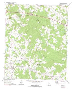
Mansfield Topo Map Georgia
To zoom in, hover over the map of Mansfield
USGS Topo Quad 33083e6 - 1:24,000 scale
| Topo Map Name: | Mansfield |
| USGS Topo Quad ID: | 33083e6 |
| Print Size: | ca. 21 1/4" wide x 27" high |
| Southeast Coordinates: | 33.5° N latitude / 83.625° W longitude |
| Map Center Coordinates: | 33.5625° N latitude / 83.6875° W longitude |
| U.S. State: | GA |
| Filename: | o33083e6.jpg |
| Download Map JPG Image: | Mansfield topo map 1:24,000 scale |
| Map Type: | Topographic |
| Topo Series: | 7.5´ |
| Map Scale: | 1:24,000 |
| Source of Map Images: | United States Geological Survey (USGS) |
| Alternate Map Versions: |
Mansfield GA 1972, updated 1974 Download PDF Buy paper map Mansfield GA 1972, updated 1991 Download PDF Buy paper map Mansfield GA 2011 Download PDF Buy paper map Mansfield GA 2014 Download PDF Buy paper map |
1:24,000 Topo Quads surrounding Mansfield
> Back to 33083e1 at 1:100,000 scale
> Back to 33082a1 at 1:250,000 scale
> Back to U.S. Topo Maps home
Mansfield topo map: Gazetteer
Mansfield: Airports
Kennedy International Airport elevation 194m 636′Morrow Meadows Airport elevation 207m 679′
Mansfield: Bridges
Cooper Bridge elevation 182m 597′Durden Bridge elevation 171m 561′
Mansfield: Crossings
Exit 48 elevation 231m 757′Exit 49 elevation 215m 705′
Mansfield: Dams
Bowden Lake Dam elevation 189m 620′Duvall Lake Dam elevation 227m 744′
Hays Pond Dam elevation 208m 682′
Kenilworth Lake Dam elevation 196m 643′
Kennedy Dam elevation 199m 652′
Mores Pond Dam elevation 220m 721′
Stokes Lake Dam elevation 203m 666′
Mansfield: Populated Places
Broughton elevation 222m 728′Deer Track elevation 225m 738′
Jerusalem elevation 233m 764′
Mansfield elevation 232m 761′
Morrow elevation 225m 738′
Newborn elevation 223m 731′
Pine Grove elevation 238m 780′
Quail Valley elevation 250m 820′
Surry Chase elevation 234m 767′
Willow Woods elevation 247m 810′
Mansfield: Reservoirs
Bowden Lake elevation 189m 620′Duvall Lake elevation 227m 744′
Hays Pond elevation 208m 682′
Kenilworth Lake elevation 196m 643′
Kennedy Lake elevation 199m 652′
Mores Pond elevation 220m 721′
Stokes Lake elevation 203m 666′
Mansfield: Streams
Dennis Creek elevation 187m 613′Gibson Branch elevation 193m 633′
Glass Creek elevation 189m 620′
Hunnicut Creek elevation 175m 574′
Nelson Creek elevation 190m 623′
Patrick Branch elevation 193m 633′
Shoal Creek elevation 170m 557′
Tanyard Branch elevation 179m 587′
Mansfield digital topo map on disk
Buy this Mansfield topo map showing relief, roads, GPS coordinates and other geographical features, as a high-resolution digital map file on DVD:
South Carolina, Western North Carolina & Northeastern Georgia
Buy digital topo maps: South Carolina, Western North Carolina & Northeastern Georgia


