Lexington Topo Map Georgia
To zoom in, hover over the map of Lexington
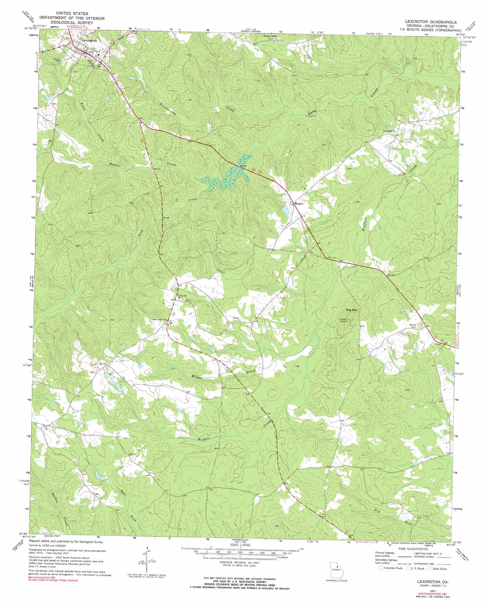
USGS Topo Quad 33083g1 - 1:24,000 scale
| Topo Map Name: | Lexington |
| USGS Topo Quad ID: | 33083g1 |
| Print Size: | ca. 21 1/4" wide x 27" high |
| Southeast Coordinates: | 33.75° N latitude / 83° W longitude |
| Map Center Coordinates: | 33.8125° N latitude / 83.0625° W longitude |
| U.S. State: | GA |
| Filename: | o33083g1.jpg |
| Download Map JPG Image: | Lexington topo map 1:24,000 scale |
| Map Type: | Topographic |
| Topo Series: | 7.5´ |
| Map Scale: | 1:24,000 |
| Source of Map Images: | United States Geological Survey (USGS) |
| Alternate Map Versions: |
Lexington GA 1971, updated 1973 Download PDF Buy paper map Lexington GA 2011 Download PDF Buy paper map Lexington GA 2014 Download PDF Buy paper map |
1:24,000 Topo Quads surrounding Lexington
Hull |
Danielsville South |
Carlton |
Elberton West |
Elberton East |
Athens East |
Crawford |
Sandy Cross |
Vesta |
Jacksons Crossroads |
Barnett Shoals |
Maxeys |
Lexington |
Rayle |
Celeste |
Greshamville |
Penfield |
Woodville |
Philomath |
Washington West |
Buckhead |
Greensboro |
Union Point |
Crawfordville |
Sharon |
> Back to 33083e1 at 1:100,000 scale
> Back to 33082a1 at 1:250,000 scale
> Back to U.S. Topo Maps home
Lexington topo map: Gazetteer
Lexington: Airports
Bobby Maxwell Airstrip elevation 196m 643′Lexington: Mines
Guarentee Mine elevation 193m 633′Lexington: Parks
Lexington Historic District elevation 214m 702′Lexington: Populated Places
Hogan elevation 202m 662′Lexington elevation 214m 702′
Lexington: Streams
Brooks Creek elevation 165m 541′Milner Brook elevation 172m 564′
Town Creek elevation 181m 593′
Troublesome Creek elevation 162m 531′
Lexington: Summits
Big Mountain elevation 230m 754′Lexington digital topo map on disk
Buy this Lexington topo map showing relief, roads, GPS coordinates and other geographical features, as a high-resolution digital map file on DVD:
South Carolina, Western North Carolina & Northeastern Georgia
Buy digital topo maps: South Carolina, Western North Carolina & Northeastern Georgia