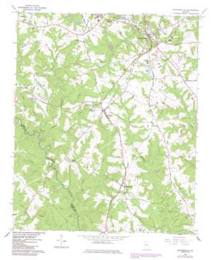
Watkinsville Topo Map Georgia
To zoom in, hover over the map of Watkinsville
USGS Topo Quad 33083g4 - 1:24,000 scale
| Topo Map Name: | Watkinsville |
| USGS Topo Quad ID: | 33083g4 |
| Print Size: | ca. 21 1/4" wide x 27" high |
| Southeast Coordinates: | 33.75° N latitude / 83.375° W longitude |
| Map Center Coordinates: | 33.8125° N latitude / 83.4375° W longitude |
| U.S. State: | GA |
| Filename: | o33083g4.jpg |
| Download Map JPG Image: | Watkinsville topo map 1:24,000 scale |
| Map Type: | Topographic |
| Topo Series: | 7.5´ |
| Map Scale: | 1:24,000 |
| Source of Map Images: | United States Geological Survey (USGS) |
| Alternate Map Versions: |
Watkinsville GA 1964, updated 1965 Download PDF Buy paper map Watkinsville GA 2011 Download PDF Buy paper map Watkinsville GA 2014 Download PDF Buy paper map |
1:24,000 Topo Quads surrounding Watkinsville
> Back to 33083e1 at 1:100,000 scale
> Back to 33082a1 at 1:250,000 scale
> Back to U.S. Topo Maps home
Watkinsville topo map: Gazetteer
Watkinsville: Bends
Gun Point Bend elevation 171m 561′Horseshoe Bend elevation 171m 561′
Watkinsville: Bridges
Price Mill Bridge elevation 166m 544′Watkinsville: Dams
Bells Lake Dam elevation 221m 725′Watkinsville: Parks
Harris Shoals Park elevation 202m 662′Herman C Michael Park elevation 243m 797′
South Main Street Historic District elevation 221m 725′
Watkinsville: Populated Places
Bishop elevation 238m 780′Cedar Hills elevation 225m 738′
Coventry elevation 219m 718′
Crossties elevation 222m 728′
Cumberland elevation 238m 780′
Elder Heights elevation 228m 748′
Elder Ridge elevation 230m 754′
Essex elevation 226m 741′
Farmington elevation 226m 741′
Harden Hills elevation 232m 761′
Hillcrest elevation 226m 741′
Killarney West elevation 226m 741′
Lake Wildwood elevation 212m 695′
Laurel Chase elevation 231m 757′
Marshall Estates elevation 229m 751′
Paradise Falls elevation 195m 639′
Poplar Springs elevation 233m 764′
Quail Run elevation 232m 761′
Rehoboth (historical) elevation 219m 718′
The Briars elevation 214m 702′
Tramlin Acres elevation 213m 698′
Victoria Station elevation 199m 652′
Watkinsville elevation 219m 718′
Westbury elevation 237m 777′
Watkinsville: Post Offices
Farmington Post Office elevation 226m 741′Watkinsville Post Office elevation 224m 734′
Watkinsville: Reservoirs
Barnett Lake elevation 226m 741′Bells Lake elevation 221m 725′
Christian Lake elevation 201m 659′
Lake Rossie elevation 202m 662′
Lake Wildwood elevation 207m 679′
Watkinsville: Streams
Bucks Creek elevation 189m 620′Frazer Creek elevation 177m 580′
Freeman Creek elevation 159m 521′
Lampkin Branch elevation 195m 639′
Robinson Creek elevation 171m 561′
Robinson Creek elevation 177m 580′
Whitlow Creek elevation 183m 600′
Watkinsville digital topo map on disk
Buy this Watkinsville topo map showing relief, roads, GPS coordinates and other geographical features, as a high-resolution digital map file on DVD:
South Carolina, Western North Carolina & Northeastern Georgia
Buy digital topo maps: South Carolina, Western North Carolina & Northeastern Georgia


