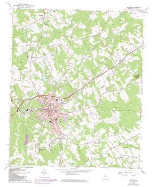
Monroe Topo Map Georgia
To zoom in, hover over the map of Monroe
USGS Topo Quad 33083g6 - 1:24,000 scale
| Topo Map Name: | Monroe |
| USGS Topo Quad ID: | 33083g6 |
| Print Size: | ca. 21 1/4" wide x 27" high |
| Southeast Coordinates: | 33.75° N latitude / 83.625° W longitude |
| Map Center Coordinates: | 33.8125° N latitude / 83.6875° W longitude |
| U.S. State: | GA |
| Filename: | o33083g6.jpg |
| Download Map JPG Image: | Monroe topo map 1:24,000 scale |
| Map Type: | Topographic |
| Topo Series: | 7.5´ |
| Map Scale: | 1:24,000 |
| Source of Map Images: | United States Geological Survey (USGS) |
| Alternate Map Versions: |
Monroe GA 1964, updated 1965 Download PDF Buy paper map Monroe GA 1964, updated 1975 Download PDF Buy paper map Monroe GA 1964, updated 1986 Download PDF Buy paper map Monroe GA 2011 Download PDF Buy paper map Monroe GA 2014 Download PDF Buy paper map |
1:24,000 Topo Quads surrounding Monroe
> Back to 33083e1 at 1:100,000 scale
> Back to 33082a1 at 1:250,000 scale
> Back to U.S. Topo Maps home
Monroe topo map: Gazetteer
Monroe: Airports
Aerie Airport elevation 249m 816′Monroe-Walton County Airport elevation 256m 839′
Walton County Hospital Heliport elevation 269m 882′
Monroe: Dams
Aycock Lake Dam elevation 242m 793′Bucaneer Lake Dam elevation 253m 830′
Gunther Dam elevation 236m 774′
Mitchell Lake Dam elevation 255m 836′
Sewage Treatment Pond Number One Dam elevation 230m 754′
Sewage Treatment Pond Number Two Dam elevation 224m 734′
Waller Dam elevation 249m 816′
Wrights Dam elevation 227m 744′
Monroe: Parks
Club Park elevation 273m 895′Dennis Coker City Park elevation 261m 856′
East Church Street Historic District elevation 276m 905′
East Marable Street Historic District elevation 275m 902′
Hammond Street Park elevation 256m 839′
Mathews Park elevation 249m 816′
McDaniel Street Historic District elevation 277m 908′
Monland Place Historic District elevation 273m 895′
Monroe and Walton Mills Historic District elevation 273m 895′
Monroe Commercial Historic District elevation 277m 908′
North Broad Street Historic District elevation 281m 921′
South Broad Street Historic District elevation 274m 898′
South Madison Avenue-Pannell Road Historic District elevation 269m 882′
Monroe: Populated Places
Campton elevation 280m 918′Cleaton (historical) elevation 264m 866′
Monroe elevation 277m 908′
Mount Vernon elevation 250m 820′
Pannell elevation 264m 866′
Walker Park elevation 287m 941′
Monroe: Post Offices
Monroe Post Office elevation 277m 908′Monroe: Reservoirs
Aycock Lake elevation 242m 793′Bucaneer Lake elevation 253m 830′
Gunther Lake elevation 236m 774′
Mitchell Lake elevation 255m 836′
Sewage Treatment Pond Number One elevation 230m 754′
Sewage Treatment Pond Number Two elevation 224m 734′
Waller Lake elevation 249m 816′
Monroe: Streams
Grubby Creek elevation 220m 721′Little Shoal Creek elevation 217m 711′
Monroe: Summits
Jacks Creek Mountain elevation 300m 984′Monroe digital topo map on disk
Buy this Monroe topo map showing relief, roads, GPS coordinates and other geographical features, as a high-resolution digital map file on DVD:
South Carolina, Western North Carolina & Northeastern Georgia
Buy digital topo maps: South Carolina, Western North Carolina & Northeastern Georgia


