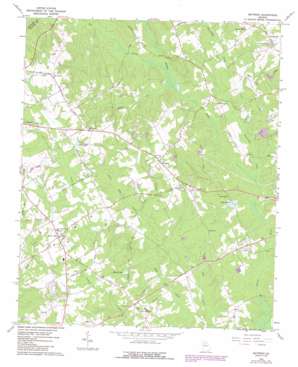
Between Topo Map Georgia
To zoom in, hover over the map of Between
USGS Topo Quad 33083g7 - 1:24,000 scale
| Topo Map Name: | Between |
| USGS Topo Quad ID: | 33083g7 |
| Print Size: | ca. 21 1/4" wide x 27" high |
| Southeast Coordinates: | 33.75° N latitude / 83.75° W longitude |
| Map Center Coordinates: | 33.8125° N latitude / 83.8125° W longitude |
| U.S. State: | GA |
| Filename: | o33083g7.jpg |
| Download Map JPG Image: | Between topo map 1:24,000 scale |
| Map Type: | Topographic |
| Topo Series: | 7.5´ |
| Map Scale: | 1:24,000 |
| Source of Map Images: | United States Geological Survey (USGS) |
| Alternate Map Versions: |
Between GA 1964, updated 1965 Download PDF Buy paper map Between GA 1964, updated 1985 Download PDF Buy paper map Between GA 2011 Download PDF Buy paper map Between GA 2014 Download PDF Buy paper map |
1:24,000 Topo Quads surrounding Between
> Back to 33083e1 at 1:100,000 scale
> Back to 33082a1 at 1:250,000 scale
> Back to U.S. Topo Maps home
Between topo map: Gazetteer
Between: Airports
Spring Valley Farm Airport elevation 269m 882′Between: Dams
Black Dam elevation 251m 823′Camp Dam elevation 239m 784′
House Lake Dam elevation 235m 770′
Lake Monroe Dam elevation 229m 751′
Stuarts Lake Dam elevation 237m 777′
Williamson Lake Dam elevation 233m 764′
Between: Populated Places
Between elevation 293m 961′Nicholasville elevation 282m 925′
Split Silk elevation 282m 925′
Youth elevation 281m 921′
Between: Reservoirs
Black Lake elevation 251m 823′Byrds Lake elevation 280m 918′
Camp Lake elevation 239m 784′
House Lake elevation 235m 770′
Lake Monroe elevation 229m 751′
Rays Lake elevation 264m 866′
Stuarrts Lake elevation 233m 764′
Stuarts Lake elevation 237m 777′
Williamson Lake elevation 233m 764′
Between: Streams
Baker Branch elevation 241m 790′Bay Creek elevation 223m 731′
Beaverdam Creek elevation 218m 715′
Maple Creek elevation 223m 731′
Wolf Creek elevation 232m 761′
Between digital topo map on disk
Buy this Between topo map showing relief, roads, GPS coordinates and other geographical features, as a high-resolution digital map file on DVD:
South Carolina, Western North Carolina & Northeastern Georgia
Buy digital topo maps: South Carolina, Western North Carolina & Northeastern Georgia


