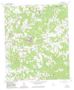
Ola Topo Map Georgia
To zoom in, hover over the map of Ola
USGS Topo Quad 33084d1 - 1:24,000 scale
| Topo Map Name: | Ola |
| USGS Topo Quad ID: | 33084d1 |
| Print Size: | ca. 21 1/4" wide x 27" high |
| Southeast Coordinates: | 33.375° N latitude / 84° W longitude |
| Map Center Coordinates: | 33.4375° N latitude / 84.0625° W longitude |
| U.S. State: | GA |
| Filename: | o33084d1.jpg |
| Download Map JPG Image: | Ola topo map 1:24,000 scale |
| Map Type: | Topographic |
| Topo Series: | 7.5´ |
| Map Scale: | 1:24,000 |
| Source of Map Images: | United States Geological Survey (USGS) |
| Alternate Map Versions: |
Ola GA 1964, updated 1965 Download PDF Buy paper map Ola GA 1964, updated 1975 Download PDF Buy paper map Ola GA 1964, updated 1983 Download PDF Buy paper map Ola GA 2011 Download PDF Buy paper map Ola GA 2014 Download PDF Buy paper map |
1:24,000 Topo Quads surrounding Ola
> Back to 33084a1 at 1:100,000 scale
> Back to 33084a1 at 1:250,000 scale
> Back to U.S. Topo Maps home
Ola topo map: Gazetteer
Ola: Airports
Zips Airport elevation 251m 823′Ola: Bridges
Air Line Bridge elevation 199m 652′Butler Bridge elevation 176m 577′
Copelands Bridge elevation 180m 590′
Double Bridges elevation 201m 659′
McMillens Bridge elevation 195m 639′
Sowell Bridge elevation 229m 751′
Ola: Dams
Boyds Lake Dam elevation 229m 751′Duggan Lake Dam elevation 204m 669′
Hardeman Dam elevation 231m 757′
Iris Lake East Dam elevation 237m 777′
Jones Lake Dam elevation 192m 629′
Lake Ola Dam elevation 206m 675′
Rape Lake Dam elevation 226m 741′
Stroup Lake Dam elevation 202m 662′
Ola: Populated Places
Ola elevation 243m 797′Peeksville elevation 211m 692′
Unity Grove elevation 246m 807′
Ola: Reservoirs
Boyds Lake elevation 229m 751′Duggan Lake elevation 204m 669′
Hardeman Lake elevation 231m 757′
Iris Lake East elevation 237m 777′
Iris Lakes elevation 237m 777′
Jones Lake elevation 192m 629′
Lake Dow elevation 210m 688′
Lake Ola elevation 206m 675′
Rape Lake elevation 226m 741′
Stroup Lake elevation 202m 662′
Ola: Streams
Freeman Creek elevation 176m 577′Honey Creek elevation 175m 574′
Kalves Creek elevation 188m 616′
Nails Creek elevation 180m 590′
Rocky Branch elevation 202m 662′
Tussahaw Branch elevation 201m 659′
Walnut Creek elevation 176m 577′
Ola digital topo map on disk
Buy this Ola topo map showing relief, roads, GPS coordinates and other geographical features, as a high-resolution digital map file on DVD:


