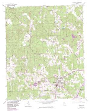
Palmetto Topo Map Georgia
To zoom in, hover over the map of Palmetto
USGS Topo Quad 33084e6 - 1:24,000 scale
| Topo Map Name: | Palmetto |
| USGS Topo Quad ID: | 33084e6 |
| Print Size: | ca. 21 1/4" wide x 27" high |
| Southeast Coordinates: | 33.5° N latitude / 84.625° W longitude |
| Map Center Coordinates: | 33.5625° N latitude / 84.6875° W longitude |
| U.S. State: | GA |
| Filename: | o33084e6.jpg |
| Download Map JPG Image: | Palmetto topo map 1:24,000 scale |
| Map Type: | Topographic |
| Topo Series: | 7.5´ |
| Map Scale: | 1:24,000 |
| Source of Map Images: | United States Geological Survey (USGS) |
| Alternate Map Versions: |
Palmetto GA 1954, updated 1955 Download PDF Buy paper map Palmetto GA 1954, updated 1969 Download PDF Buy paper map Palmetto GA 1954, updated 1983 Download PDF Buy paper map Palmetto GA 1954, updated 1983 Download PDF Buy paper map Palmetto GA 2011 Download PDF Buy paper map Palmetto GA 2014 Download PDF Buy paper map |
1:24,000 Topo Quads surrounding Palmetto
> Back to 33084e1 at 1:100,000 scale
> Back to 33084a1 at 1:250,000 scale
> Back to U.S. Topo Maps home
Palmetto topo map: Gazetteer
Palmetto: Airports
South Fulton Airport elevation 314m 1030′Palmetto: Crossings
Interchange Eleven elevation 298m 977′Smith Ferry (historical) elevation 220m 721′
Palmetto: Dams
Cedar Grove Dam elevation 267m 875′Cedar Lake Dam elevation 280m 918′
Goodes Lake Dam elevation 266m 872′
Horsehead Lake Dam elevation 257m 843′
Ono Road Lake Dam elevation 275m 902′
Redding Lake Dam elevation 288m 944′
Telephone Lake Dam elevation 257m 843′
Palmetto: Parks
Cedar Grove Park elevation 307m 1007′Cochrane Mill Park elevation 242m 793′
Palmetto: Populated Places
Bear Creek Estates elevation 305m 1000′Cackle Corner elevation 259m 849′
Carlton Woods elevation 299m 980′
Goodes elevation 286m 938′
Green Springs elevation 285m 935′
Lester elevation 282m 925′
Palmetto elevation 311m 1020′
Rivertown elevation 252m 826′
South Oak Mobile Home Park elevation 276m 905′
Sweet Briar Mobile Home Park elevation 278m 912′
Palmetto: Post Offices
Palmetto Post Office elevation 311m 1020′Palmetto: Reservoirs
Cedar Grove Lake elevation 267m 875′Cedar Lake elevation 280m 918′
Goodes Lake elevation 266m 872′
Horsehead Lake elevation 257m 843′
Ono Road Lake elevation 275m 902′
Redding Lake elevation 288m 944′
Telephone Lake elevation 255m 836′
Palmetto: Streams
Cedar Branch elevation 241m 790′Fox Den Branch elevation 237m 777′
Little Bear Creek elevation 241m 790′
Little Pea Creek elevation 231m 757′
Pea Creek elevation 220m 721′
Palmetto digital topo map on disk
Buy this Palmetto topo map showing relief, roads, GPS coordinates and other geographical features, as a high-resolution digital map file on DVD:


