Daviston Topo Map Alabama
To zoom in, hover over the map of Daviston
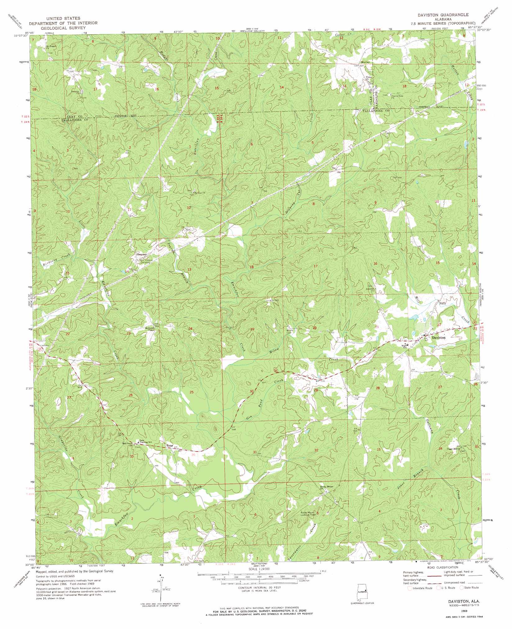
USGS Topo Quad 33085a6 - 1:24,000 scale
| Topo Map Name: | Daviston |
| USGS Topo Quad ID: | 33085a6 |
| Print Size: | ca. 21 1/4" wide x 27" high |
| Southeast Coordinates: | 33° N latitude / 85.625° W longitude |
| Map Center Coordinates: | 33.0625° N latitude / 85.6875° W longitude |
| U.S. State: | AL |
| Filename: | o33085a6.jpg |
| Download Map JPG Image: | Daviston topo map 1:24,000 scale |
| Map Type: | Topographic |
| Topo Series: | 7.5´ |
| Map Scale: | 1:24,000 |
| Source of Map Images: | United States Geological Survey (USGS) |
| Alternate Map Versions: |
Daviston AL 1969, updated 1973 Download PDF Buy paper map Daviston AL 2011 Download PDF Buy paper map Daviston AL 2014 Download PDF Buy paper map |
1:24,000 Topo Quads surrounding Daviston
Clairmont Springs |
Lineville West |
Lineville East |
Ofelia |
Wedowee |
Millerville |
Gibsonville |
Mellow Valley |
Wadley North |
Roanoke West |
Hackneyville |
New Site |
Daviston |
Wadley South |
Milltown |
Alexander City |
Jacksons Gap |
Buttston |
Dudleyville |
Lafayette |
Our Town |
Dadeville |
Camp Hill |
Camp Hill Se |
Moorefield |
> Back to 33085a1 at 1:100,000 scale
> Back to 33084a1 at 1:250,000 scale
> Back to U.S. Topo Maps home
Daviston topo map: Gazetteer
Daviston: Populated Places
Daviston elevation 232m 761′Emuckfaw (historical) elevation 239m 784′
Motley elevation 285m 935′
Simpson elevation 243m 797′
Zana elevation 211m 692′
Zana (historical) elevation 224m 734′
Daviston: Post Offices
Daviston Post Office elevation 233m 764′Daviston: Streams
Birdsong Creek elevation 218m 715′Dipping Vat Creek elevation 204m 669′
Gin Pond Creek elevation 188m 616′
Grapevine Creek elevation 175m 574′
Hodges Creek elevation 222m 728′
Ingram Branch elevation 195m 639′
Jones Branch elevation 187m 613′
Little Emuckfaw Creek elevation 187m 613′
Milam Creek elevation 191m 626′
Daviston digital topo map on disk
Buy this Daviston topo map showing relief, roads, GPS coordinates and other geographical features, as a high-resolution digital map file on DVD: