Glenn Topo Map Georgia
To zoom in, hover over the map of Glenn
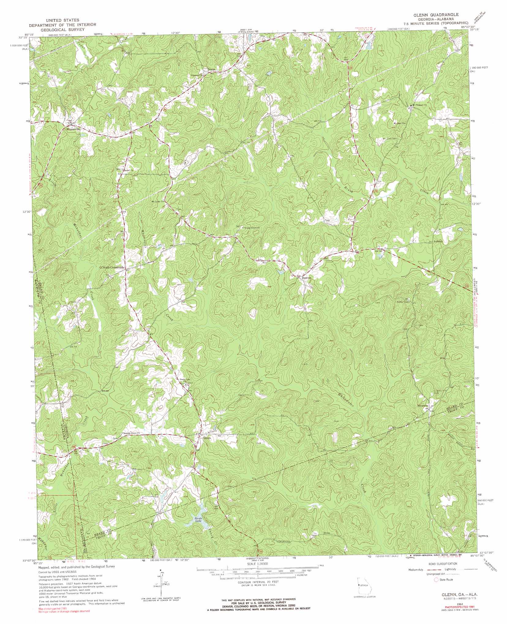
USGS Topo Quad 33085b2 - 1:24,000 scale
| Topo Map Name: | Glenn |
| USGS Topo Quad ID: | 33085b2 |
| Print Size: | ca. 21 1/4" wide x 27" high |
| Southeast Coordinates: | 33.125° N latitude / 85.125° W longitude |
| Map Center Coordinates: | 33.1875° N latitude / 85.1875° W longitude |
| U.S. States: | GA, AL |
| Filename: | o33085b2.jpg |
| Download Map JPG Image: | Glenn topo map 1:24,000 scale |
| Map Type: | Topographic |
| Topo Series: | 7.5´ |
| Map Scale: | 1:24,000 |
| Source of Map Images: | United States Geological Survey (USGS) |
| Alternate Map Versions: |
Glenn GA 1964, updated 1966 Download PDF Buy paper map Glenn GA 1964, updated 1991 Download PDF Buy paper map Glenn GA 2011 Download PDF Buy paper map Glenn GA 2014 Download PDF Buy paper map |
1:24,000 Topo Quads surrounding Glenn
Newell |
Graham |
Roopville |
Lowell |
Whitesburg |
Wedowee |
Napoleon |
Frolona |
Franklin |
Newnan Sw |
Roanoke West |
Roanoke East |
Glenn |
Hillcrest |
Hogansville |
Milltown |
Five Points |
Abbottsford |
La Grange |
Mountville |
Lafayette |
Fredonia |
Lanett North |
Cannonville |
Hilyer |
> Back to 33085a1 at 1:100,000 scale
> Back to 33084a1 at 1:250,000 scale
> Back to U.S. Topo Maps home
Glenn topo map: Gazetteer
Glenn: Airports
Panacea Airport elevation 245m 803′Glenn: Dams
Reeds Dam elevation 228m 748′Glenn: Populated Places
Aubrey elevation 227m 744′Denver elevation 250m 820′
Glenn elevation 250m 820′
Houston elevation 254m 833′
Kirk elevation 234m 767′
O'Neals Crossroad elevation 262m 859′
Texas elevation 285m 935′
Waresville elevation 282m 925′
Glenn: Post Offices
Glenn Post Office elevation 250m 820′Glenn: Reservoirs
Reeds Lake elevation 228m 748′Glenn: Streams
Little Wehadkee Creek elevation 198m 649′Little Wehadkee Creek elevation 198m 649′
Glenn digital topo map on disk
Buy this Glenn topo map showing relief, roads, GPS coordinates and other geographical features, as a high-resolution digital map file on DVD: