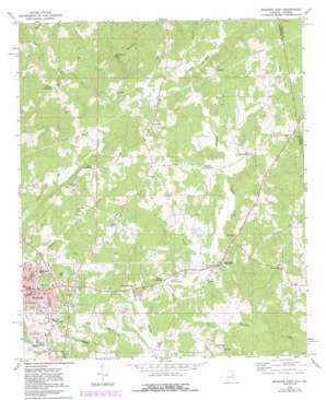
Roanoke East Topo Map Alabama
To zoom in, hover over the map of Roanoke East
USGS Topo Quad 33085b3 - 1:24,000 scale
| Topo Map Name: | Roanoke East |
| USGS Topo Quad ID: | 33085b3 |
| Print Size: | ca. 21 1/4" wide x 27" high |
| Southeast Coordinates: | 33.125° N latitude / 85.25° W longitude |
| Map Center Coordinates: | 33.1875° N latitude / 85.3125° W longitude |
| U.S. States: | AL, GA |
| Filename: | o33085b3.jpg |
| Download Map JPG Image: | Roanoke East topo map 1:24,000 scale |
| Map Type: | Topographic |
| Topo Series: | 7.5´ |
| Map Scale: | 1:24,000 |
| Source of Map Images: | United States Geological Survey (USGS) |
| Alternate Map Versions: |
Roanoke East AL 1969, updated 1973 Download PDF Buy paper map Roanoke East AL 1969, updated 1984 Download PDF Buy paper map Roanoke East AL 2011 Download PDF Buy paper map Roanoke East AL 2011 Download PDF Buy paper map Roanoke East AL 2014 Download PDF Buy paper map |
1:24,000 Topo Quads surrounding Roanoke East
> Back to 33085a1 at 1:100,000 scale
> Back to 33084a1 at 1:250,000 scale
> Back to U.S. Topo Maps home
Roanoke East topo map: Gazetteer
Roanoke East: Airports
Roanoke Municipal Airport elevation 268m 879′Roanoke East: Dams
High Pine Creek Watershed Dam Number 3 elevation 239m 784′Highpine Creek Watershed Dam Number 1 elevation 260m 853′
Rice Dam elevation 257m 843′
Schuessler Dam elevation 260m 853′
Roanoke East: Falls
High Shoals Falls elevation 275m 902′Roanoke East: Lakes
Bell Lake elevation 239m 784′Roanoke East: Populated Places
Bacon Level elevation 229m 751′Barrett Crossroads elevation 264m 866′
Center Chapel elevation 280m 918′
High Shoals elevation 328m 1076′
Lee Crossroads elevation 244m 800′
Lime elevation 250m 820′
Moores Crossroads elevation 267m 875′
Paran elevation 281m 921′
Roanoke elevation 258m 846′
Rock Mills elevation 238m 780′
Springfield elevation 294m 964′
Taylors Crossroads elevation 331m 1085′
Wehadkee elevation 295m 967′
White Crossroads elevation 285m 935′
Roanoke East: Post Offices
Roanoke Post Office elevation 259m 849′Roanoke East: Reservoirs
Bartlett Pond elevation 257m 843′High Pine Creek Lake Number 3 elevation 239m 784′
Highpine Creek Lake Number 1 elevation 260m 853′
Rice Pond elevation 257m 843′
Roanoke East: Streams
Little Wehadkee Branch elevation 247m 810′Stitt Branch elevation 248m 813′
Vineyard Branch elevation 229m 751′
Roanoke East digital topo map on disk
Buy this Roanoke East topo map showing relief, roads, GPS coordinates and other geographical features, as a high-resolution digital map file on DVD:


