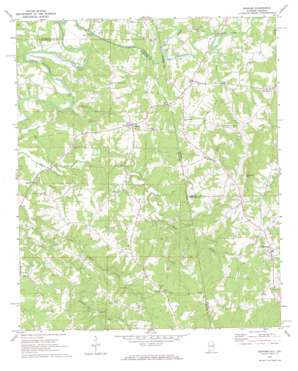
Graham Topo Map Alabama
To zoom in, hover over the map of Graham
USGS Topo Quad 33085d3 - 1:24,000 scale
| Topo Map Name: | Graham |
| USGS Topo Quad ID: | 33085d3 |
| Print Size: | ca. 21 1/4" wide x 27" high |
| Southeast Coordinates: | 33.375° N latitude / 85.25° W longitude |
| Map Center Coordinates: | 33.4375° N latitude / 85.3125° W longitude |
| U.S. States: | AL, GA |
| Filename: | o33085d3.jpg |
| Download Map JPG Image: | Graham topo map 1:24,000 scale |
| Map Type: | Topographic |
| Topo Series: | 7.5´ |
| Map Scale: | 1:24,000 |
| Source of Map Images: | United States Geological Survey (USGS) |
| Alternate Map Versions: |
Graham AL 1969, updated 1973 Download PDF Buy paper map Graham AL 1969, updated 1973 Download PDF Buy paper map Graham AL 1975, updated 1977 Download PDF Buy paper map Graham AL 2011 Download PDF Buy paper map Graham AL 2011 Download PDF Buy paper map Graham AL 2014 Download PDF Buy paper map |
1:24,000 Topo Quads surrounding Graham
> Back to 33085a1 at 1:100,000 scale
> Back to 33084a1 at 1:250,000 scale
> Back to U.S. Topo Maps home
Graham topo map: Gazetteer
Graham: Bridges
Coles Bridge elevation 268m 879′Muckfau Bridge elevation 273m 895′
Thompson Bridge elevation 272m 892′
Graham: Dams
West Lake Dam elevation 287m 941′Graham: Populated Places
Bethel elevation 415m 1361′Bucktown elevation 294m 964′
Burgess elevation 415m 1361′
Ephesus elevation 377m 1236′
Graham elevation 336m 1102′
Hawk elevation 296m 971′
Kaylor elevation 274m 898′
Providence elevation 324m 1062′
Sewell elevation 381m 1250′
Graham: Post Offices
Graham Post Office elevation 335m 1099′Graham: Reservoirs
West Lake elevation 287m 941′Graham: Streams
Bud Coffee Branch elevation 278m 912′Coppers Rock Creek elevation 268m 879′
Farmer Creek elevation 273m 895′
Indian Creek elevation 279m 915′
Knight Branch elevation 268m 879′
Knokes Creek elevation 265m 869′
Lovvorn Creek elevation 280m 918′
Rice Branch elevation 268m 879′
Tanyard Branch elevation 278m 912′
Tanyard Branch elevation 278m 912′
Graham: Summits
Blackjack Mountain elevation 472m 1548′Graham digital topo map on disk
Buy this Graham topo map showing relief, roads, GPS coordinates and other geographical features, as a high-resolution digital map file on DVD:


