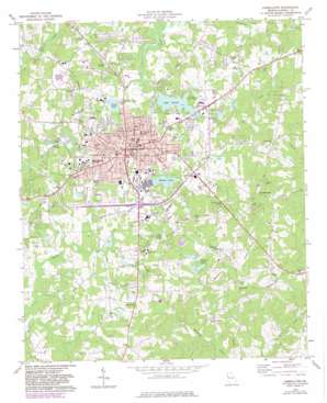
Carrollton Topo Map Georgia
To zoom in, hover over the map of Carrollton
USGS Topo Quad 33085e1 - 1:24,000 scale
| Topo Map Name: | Carrollton |
| USGS Topo Quad ID: | 33085e1 |
| Print Size: | ca. 21 1/4" wide x 27" high |
| Southeast Coordinates: | 33.5° N latitude / 85° W longitude |
| Map Center Coordinates: | 33.5625° N latitude / 85.0625° W longitude |
| U.S. State: | GA |
| Filename: | o33085e1.jpg |
| Download Map JPG Image: | Carrollton topo map 1:24,000 scale |
| Map Type: | Topographic |
| Topo Series: | 7.5´ |
| Map Scale: | 1:24,000 |
| Source of Map Images: | United States Geological Survey (USGS) |
| Alternate Map Versions: |
Carrollton GA 1973, updated 1975 Download PDF Buy paper map Carrollton GA 1973, updated 1983 Download PDF Buy paper map Carrollton GA 1973, updated 1983 Download PDF Buy paper map Carrollton GA 2011 Download PDF Buy paper map Carrollton GA 2014 Download PDF Buy paper map |
1:24,000 Topo Quads surrounding Carrollton
> Back to 33085e1 at 1:100,000 scale
> Back to 33084a1 at 1:250,000 scale
> Back to U.S. Topo Maps home
Carrollton topo map: Gazetteer
Carrollton: Airports
C and R Farm Airport elevation 305m 1000′Carrollton Municipal Airport (historical) elevation 318m 1043′
Falcons Aerie Airport elevation 354m 1161′
Southwire Heliport elevation 318m 1043′
Carrollton: Bridges
Hanley Bridge elevation 299m 980′Kings Bridge elevation 298m 977′
Carrollton: Dams
Barnes Lake Dam elevation 318m 1043′Lake Carroll Dam elevation 306m 1003′
Lower Tallapoosa Structure 21 Dam elevation 315m 1033′
Patrick North Dam elevation 316m 1036′
Piney Woods Lake Dam elevation 328m 1076′
Richards Lake Dam elevation 320m 1049′
South Patrick Lake Dam elevation 314m 1030′
Sunset Hills Country Club Lake Dam elevation 310m 1017′
Walker Lake Dam elevation 313m 1026′
Carrollton: Parks
Adamson Square elevation 336m 1102′Grisham Stadium elevation 310m 1017′
South Carrollton Residential Historic District elevation 336m 1102′
Carrollton: Populated Places
Briarwood Estates elevation 327m 1072′Buck Creek (historical) elevation 316m 1036′
Carrollton elevation 336m 1102′
Castlegate East elevation 336m 1102′
Cedarwood elevation 310m 1017′
Chapel Heights Estates elevation 333m 1092′
Clem elevation 355m 1164′
Colonial Estates elevation 312m 1023′
Curtis elevation 360m 1181′
Elizabeth Village Mobile Home Park elevation 306m 1003′
Fairlawn Estates elevation 323m 1059′
Greene Valley Estates elevation 310m 1017′
Greenwood Estates elevation 321m 1053′
Hickory Heights elevation 333m 1092′
Holly Heights elevation 324m 1062′
Knob Hill elevation 345m 1131′
Lamplighter Square elevation 327m 1072′
Land-O-Plenty Subdivision elevation 311m 1020′
Leisure Heights elevation 323m 1059′
Oak Grove elevation 355m 1164′
Oak Mountain elevation 405m 1328′
Pine Ridge Estates elevation 315m 1033′
Riverbend elevation 311m 1020′
South Gate elevation 341m 1118′
Carrollton: Post Offices
Carrollton Post Office elevation 336m 1102′Carrollton: Reservoirs
Barnes Lake elevation 318m 1043′Johnson Lake elevation 303m 994′
Lake Carroll elevation 306m 1003′
Moore Lake elevation 334m 1095′
Patrick North Lake elevation 316m 1036′
Patricks Lakes elevation 315m 1033′
Richards Lake elevation 320m 1049′
Smith Lake elevation 315m 1033′
South Patrick Lake elevation 314m 1030′
Sunset Hills Country Club Lake elevation 310m 1017′
Walker Lake elevation 313m 1026′
Carrollton: Streams
Bear Creek elevation 302m 990′Curtis Creek elevation 303m 994′
Carrollton digital topo map on disk
Buy this Carrollton topo map showing relief, roads, GPS coordinates and other geographical features, as a high-resolution digital map file on DVD:


