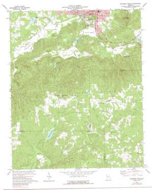
Rockmart South Topo Map Georgia
To zoom in, hover over the map of Rockmart South
USGS Topo Quad 33085h1 - 1:24,000 scale
| Topo Map Name: | Rockmart South |
| USGS Topo Quad ID: | 33085h1 |
| Print Size: | ca. 21 1/4" wide x 27" high |
| Southeast Coordinates: | 33.875° N latitude / 85° W longitude |
| Map Center Coordinates: | 33.9375° N latitude / 85.0625° W longitude |
| U.S. State: | GA |
| Filename: | o33085h1.jpg |
| Download Map JPG Image: | Rockmart South topo map 1:24,000 scale |
| Map Type: | Topographic |
| Topo Series: | 7.5´ |
| Map Scale: | 1:24,000 |
| Source of Map Images: | United States Geological Survey (USGS) |
| Alternate Map Versions: |
Rockmart South GA 1973, updated 1975 Download PDF Buy paper map Rockmart South GA 1973, updated 1988 Download PDF Buy paper map Rockmart South GA 2011 Download PDF Buy paper map Rockmart South GA 2014 Download PDF Buy paper map |
1:24,000 Topo Quads surrounding Rockmart South
> Back to 33085e1 at 1:100,000 scale
> Back to 33084a1 at 1:250,000 scale
> Back to U.S. Topo Maps home
Rockmart South topo map: Gazetteer
Rockmart South: Dams
Crawford Lake Dam elevation 295m 967′Eubank Lake Dam elevation 343m 1125′
Euharlee Structure Number 49 Dam elevation 252m 826′
King Lake Dam elevation 391m 1282′
Lake Dorene Dam elevation 238m 780′
Lower Coots Lake Dam elevation 290m 951′
Parham Springs Lake Dam elevation 252m 826′
Stringers Lake Dam elevation 260m 853′
Rockmart South: Flats
White Bottom elevation 233m 764′Rockmart South: Mines
Hicks Prospect elevation 380m 1246′Rockmart South: Populated Places
Beulah elevation 388m 1272′Van Wert elevation 244m 800′
Vinson (historical) elevation 402m 1318′
Rockmart South: Reservoirs
Camp Shepherd Lake elevation 350m 1148′Coots Lake elevation 286m 938′
Crawford Lake elevation 295m 967′
Dorene Lake elevation 238m 780′
Eubank Lake elevation 343m 1125′
Forsyth Lake elevation 264m 866′
King Lake elevation 391m 1282′
Lake Dorene elevation 253m 830′
Lower Coots Lake elevation 290m 951′
Parham Springs Lake elevation 252m 826′
Parham Springs Lake elevation 296m 971′
Stringers Lake elevation 258m 846′
Rockmart South: Springs
Parham Springs elevation 250m 820′Rockmart South: Streams
Caney Branch elevation 370m 1213′Hutchings Creek elevation 241m 790′
Parham Springs Creek elevation 244m 800′
Rabbit Branch elevation 370m 1213′
Riles Creek elevation 244m 800′
Simpson Creek elevation 227m 744′
Swinney Branch elevation 323m 1059′
Thomasson Creek elevation 341m 1118′
Thompson Creek elevation 232m 761′
Water Mill Creek elevation 325m 1066′
White Creek elevation 341m 1118′
Rockmart South: Summits
Everett Mountain elevation 384m 1259′Paris Mountain elevation 392m 1286′
Signal Mountain elevation 388m 1272′
Vinson Mountain elevation 403m 1322′
Rockmart South: Valleys
Happy Hollow elevation 355m 1164′Morgan Valley elevation 229m 751′
Rockmart South digital topo map on disk
Buy this Rockmart South topo map showing relief, roads, GPS coordinates and other geographical features, as a high-resolution digital map file on DVD:


