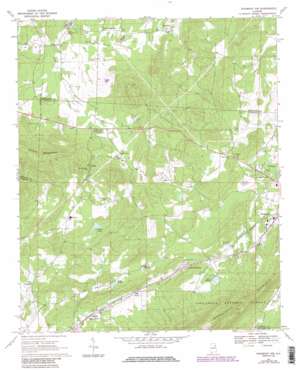
Piedmont Nw Topo Map Alabama
To zoom in, hover over the map of Piedmont Nw
USGS Topo Quad 33085h6 - 1:24,000 scale
| Topo Map Name: | Piedmont Nw |
| USGS Topo Quad ID: | 33085h6 |
| Print Size: | ca. 21 1/4" wide x 27" high |
| Southeast Coordinates: | 33.875° N latitude / 85.625° W longitude |
| Map Center Coordinates: | 33.9375° N latitude / 85.6875° W longitude |
| U.S. State: | AL |
| Filename: | o33085h6.jpg |
| Download Map JPG Image: | Piedmont Nw topo map 1:24,000 scale |
| Map Type: | Topographic |
| Topo Series: | 7.5´ |
| Map Scale: | 1:24,000 |
| Source of Map Images: | United States Geological Survey (USGS) |
| Alternate Map Versions: |
Piedmont NW AL 1967, updated 1969 Download PDF Buy paper map Piedmont NW AL 1967, updated 1985 Download PDF Buy paper map Piedmont NW AL 1967, updated 1985 Download PDF Buy paper map Piedmont NW AL 2001, updated 2004 Download PDF Buy paper map Piedmont NW AL 2011 Download PDF Buy paper map Piedmont NW AL 2014 Download PDF Buy paper map |
| FStopo: | US Forest Service topo Piedmont NW is available: Download FStopo PDF Download FStopo TIF |
1:24,000 Topo Quads surrounding Piedmont Nw
> Back to 33085e1 at 1:100,000 scale
> Back to 33084a1 at 1:250,000 scale
> Back to U.S. Topo Maps home
Piedmont Nw topo map: Gazetteer
Piedmont Nw: Dams
Boozer Dam elevation 230m 754′Haven Dam elevation 244m 800′
Hollis Dam elevation 219m 718′
Rankins Dam elevation 240m 787′
Piedmont Nw: Populated Places
Allsop elevation 205m 672′Asberry elevation 204m 669′
Collins (historical) elevation 192m 629′
Couch elevation 217m 711′
Estes Crossroads elevation 189m 620′
Gnatville elevation 207m 679′
Kearney (historical) elevation 210m 688′
Knightens Crossroads elevation 191m 626′
Maxwellborn elevation 208m 682′
Midway (historical) elevation 233m 764′
Piedmont Springs elevation 244m 800′
Prices elevation 220m 721′
Roy Webb elevation 225m 738′
Zuni (historical) elevation 219m 718′
Piedmont Nw: Post Offices
Kearney Post Office (historical) elevation 210m 688′Zuni Post Office (historical) elevation 219m 718′
Piedmont Nw: Reservoirs
Boozer Lake elevation 230m 754′Lake Haven elevation 244m 800′
Lake Hollis elevation 218m 715′
Lake Watson elevation 240m 787′
Piedmont Nw: Springs
Big Spring elevation 205m 672′Big Willow Spring elevation 207m 679′
Colliers Spring elevation 202m 662′
Collins Spring elevation 200m 656′
Hendon Spring elevation 202m 662′
Hopewell Springs elevation 209m 685′
Maxwellborn Spring elevation 202m 662′
Morehorn Spring elevation 245m 803′
Robertson Spring elevation 213m 698′
Piedmont Nw: Streams
Mill Creek elevation 182m 597′Piedmont Nw: Summits
Bald Hornet elevation 257m 843′Cherry Hill elevation 277m 908′
Penny Mountain elevation 264m 866′
Saddler Mountain elevation 307m 1007′
Piedmont Nw digital topo map on disk
Buy this Piedmont Nw topo map showing relief, roads, GPS coordinates and other geographical features, as a high-resolution digital map file on DVD:


