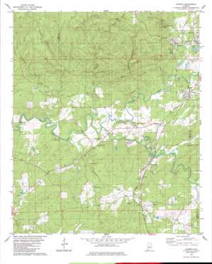
Aldrich Topo Map Alabama
To zoom in, hover over the map of Aldrich
USGS Topo Quad 33086a8 - 1:24,000 scale
| Topo Map Name: | Aldrich |
| USGS Topo Quad ID: | 33086a8 |
| Print Size: | ca. 21 1/4" wide x 27" high |
| Southeast Coordinates: | 33° N latitude / 86.875° W longitude |
| Map Center Coordinates: | 33.0625° N latitude / 86.9375° W longitude |
| U.S. State: | AL |
| Filename: | o33086a8.jpg |
| Download Map JPG Image: | Aldrich topo map 1:24,000 scale |
| Map Type: | Topographic |
| Topo Series: | 7.5´ |
| Map Scale: | 1:24,000 |
| Source of Map Images: | United States Geological Survey (USGS) |
| Alternate Map Versions: |
Montevallo SW AL 1975, updated 1977 Download PDF Buy paper map Aldrich AL 1979, updated 1980 Download PDF Buy paper map Aldrich AL 1979, updated 1984 Download PDF Buy paper map Aldrich AL 2011 Download PDF Buy paper map Aldrich AL 2014 Download PDF Buy paper map |
1:24,000 Topo Quads surrounding Aldrich
> Back to 33086a1 at 1:100,000 scale
> Back to 33086a1 at 1:250,000 scale
> Back to U.S. Topo Maps home
Aldrich topo map: Gazetteer
Aldrich: Bridges
Fitch Bridge elevation 96m 314′Aldrich: Crossings
McGuire Ford elevation 89m 291′Aldrich: Dams
University of Montevallo Dam elevation 132m 433′University of Montevallo Lake Dam elevation 126m 413′
Aldrich: Falls
Davis Falls elevation 143m 469′Weaver Falls elevation 173m 567′
Aldrich: Lakes
College Lake elevation 126m 413′Aldrich: Mines
Aldrich Mine elevation 184m 603′Mary Elizabeth Mine elevation 180m 590′
Wooley Mine elevation 151m 495′
Aldrich: Populated Places
Aldrich elevation 139m 456′Almont elevation 135m 442′
Ashby elevation 139m 456′
Brierfield elevation 115m 377′
Wilton elevation 121m 396′
Aldrich: Post Offices
Brierfield Post Office elevation 122m 400′Wilton Post Office elevation 122m 400′
Aldrich: Reservoirs
University of Montevallo Lake elevation 132m 433′Aldrich: Springs
Centry Springs elevation 165m 541′Aldrich: Streams
Black Branch elevation 109m 357′Dry Creek elevation 125m 410′
Fourmile Creek elevation 100m 328′
Furnace Branch elevation 96m 314′
Jims Branch elevation 131m 429′
Little Mayberry Creek elevation 109m 357′
Mahan Creek elevation 97m 318′
Mayberry Creek elevation 102m 334′
Shoal Creek elevation 97m 318′
Splawn Branch elevation 125m 410′
Walker Branch elevation 125m 410′
Aldrich digital topo map on disk
Buy this Aldrich topo map showing relief, roads, GPS coordinates and other geographical features, as a high-resolution digital map file on DVD:


