Columbiana Topo Map Alabama
To zoom in, hover over the map of Columbiana
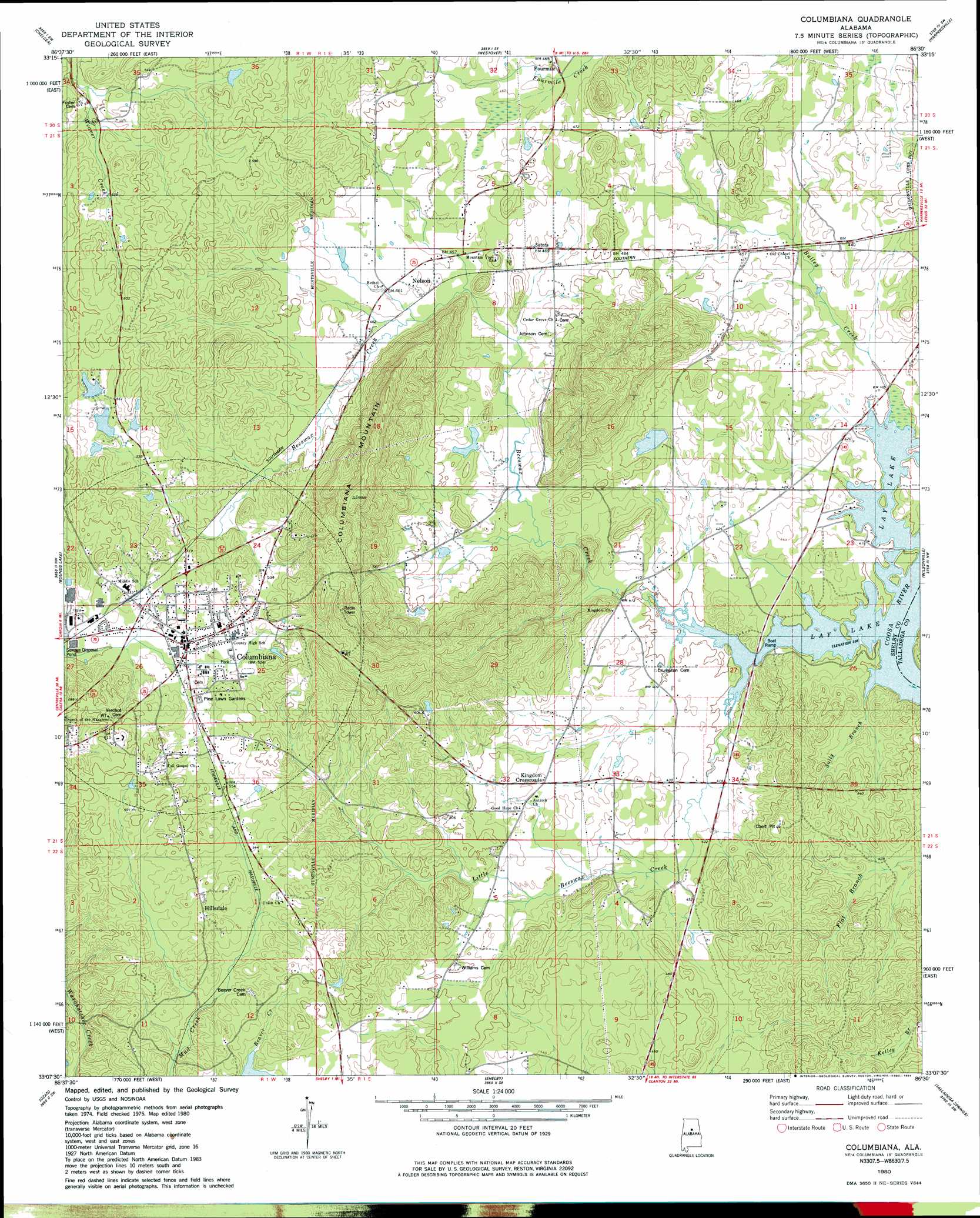
USGS Topo Quad 33086b5 - 1:24,000 scale
| Topo Map Name: | Columbiana |
| USGS Topo Quad ID: | 33086b5 |
| Print Size: | ca. 21 1/4" wide x 27" high |
| Southeast Coordinates: | 33.125° N latitude / 86.5° W longitude |
| Map Center Coordinates: | 33.1875° N latitude / 86.5625° W longitude |
| U.S. State: | AL |
| Filename: | o33086b5.jpg |
| Download Map JPG Image: | Columbiana topo map 1:24,000 scale |
| Map Type: | Topographic |
| Topo Series: | 7.5´ |
| Map Scale: | 1:24,000 |
| Source of Map Images: | United States Geological Survey (USGS) |
| Alternate Map Versions: |
Columbiana NE AL 1975, updated 1977 Download PDF Buy paper map Columbiana AL 1980, updated 1980 Download PDF Buy paper map Columbiana AL 2011 Download PDF Buy paper map Columbiana AL 2014 Download PDF Buy paper map |
1:24,000 Topo Quads surrounding Columbiana
Birmingham South |
Cahaba Heights |
Vandiver |
Vincent |
Laniers |
Helena |
Chelsea |
Westover |
Harpersville |
Childersburg |
Alabaster |
Bounds Lake |
Columbiana |
Wilsonville |
Sylacauga West |
Montevallo |
Ozan |
Shelby |
Talladega Springs |
Weogufka |
Jemison West |
Jemison East |
Lay Dam |
Mitchell Dam Nw |
Flag Mountain |
> Back to 33086a1 at 1:100,000 scale
> Back to 33086a1 at 1:250,000 scale
> Back to U.S. Topo Maps home
Columbiana topo map: Gazetteer
Columbiana: Airports
Commander Airpark Inc elevation 137m 449′Columbiana: Dams
Adams Dam elevation 168m 551′Moore Dam elevation 165m 541′
Columbiana: Populated Places
Columbiana elevation 160m 524′Fourmile elevation 141m 462′
Hillsdale elevation 171m 561′
Kingdom Crossroads elevation 140m 459′
Nelson elevation 141m 462′
Columbiana: Post Offices
Columbiana Post Office elevation 160m 524′Columbiana: Reservoirs
Adams Lake elevation 168m 551′Moore Lake elevation 165m 541′
Columbiana: Streams
Beeswax Creek elevation 119m 390′Bulley Creek elevation 121m 396′
Little Beeswax Creek elevation 119m 390′
Sally Branch elevation 119m 390′
Columbiana: Summits
Columbiana Mountain elevation 295m 967′Columbiana digital topo map on disk
Buy this Columbiana topo map showing relief, roads, GPS coordinates and other geographical features, as a high-resolution digital map file on DVD: