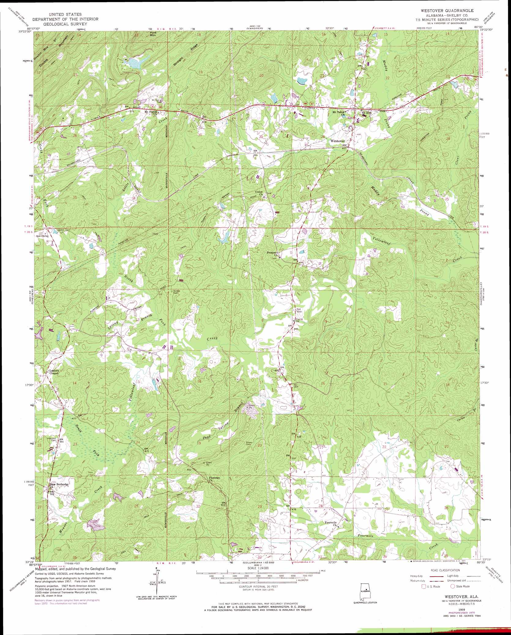
Westover Topo Map Alabama
To zoom in, hover over the map of Westover
USGS Topo Quad 33086c5 - 1:24,000 scale
| Topo Map Name: | Westover |
| USGS Topo Quad ID: | 33086c5 |
| Print Size: | ca. 21 1/4" wide x 27" high |
| Southeast Coordinates: | 33.25° N latitude / 86.5° W longitude |
| Map Center Coordinates: | 33.3125° N latitude / 86.5625° W longitude |
| U.S. State: | AL |
| Filename: | o33086c5.jpg |
| Download Map JPG Image: | Westover topo map 1:24,000 scale |
| Map Type: | Topographic |
| Topo Series: | 7.5´ |
| Map Scale: | 1:24,000 |
| Source of Map Images: | United States Geological Survey (USGS) |
| Alternate Map Versions: |
Westover AL 1959, updated 1960 Download PDF Buy paper map Westover AL 1959, updated 1969 Download PDF Buy paper map Westover AL 1959, updated 1971 Download PDF Buy paper map Westover AL 1959, updated 1978 Download PDF Buy paper map Westover AL 1975, updated 1977 Download PDF Buy paper map Westover AL 2011 Download PDF Buy paper map Westover AL 2014 Download PDF Buy paper map |
1:24,000 Topo Quads surrounding Westover
Birmingham North |
Irondale |
Leeds |
Cooks Springs |
Pell City |
Birmingham South |
Cahaba Heights |
Vandiver |
Vincent |
Laniers |
Helena |
Chelsea |
Westover |
Harpersville |
Childersburg |
Alabaster |
Bounds Lake |
Columbiana |
Wilsonville |
Sylacauga West |
Montevallo |
Ozan |
Shelby |
Talladega Springs |
Weogufka |
> Back to 33086a1 at 1:100,000 scale
> Back to 33086a1 at 1:250,000 scale
> Back to U.S. Topo Maps home
Westover topo map: Gazetteer
Westover: Bridges
Teague Bridge elevation 134m 439′Westover: Dams
Caldwell Lake Dam elevation 155m 508′Girl Scout Lake Dam elevation 174m 570′
Lake Hargis Dam elevation 167m 547′
Purdy Lake Dam elevation 160m 524′
Westover: Populated Places
Westover elevation 147m 482′Yellowleaf Creek Estates elevation 152m 498′
Westover: Post Offices
Westover Post Office elevation 145m 475′Westover: Reservoirs
Cahaba Girl Scout Council Lake elevation 174m 570′Caldwell Lake elevation 155m 508′
Hargis Lake elevation 164m 538′
Purdy Lake elevation 160m 524′
Westover: Streams
Clear Prong elevation 130m 426′Little Creek elevation 136m 446′
North Fork Yellowleaf Creek elevation 136m 446′
Page Spring Branch elevation 135m 442′
Poplar Spring Branch elevation 135m 442′
South Fork Yellowleaf Creek elevation 138m 452′
Spring Branch elevation 136m 446′
Weaver Creek elevation 141m 462′
Westover digital topo map on disk
Buy this Westover topo map showing relief, roads, GPS coordinates and other geographical features, as a high-resolution digital map file on DVD: