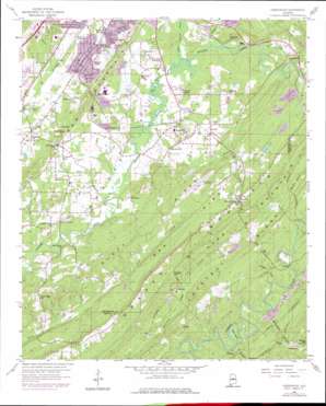
Greenwood Topo Map Alabama
To zoom in, hover over the map of Greenwood
USGS Topo Quad 33086c8 - 1:24,000 scale
| Topo Map Name: | Greenwood |
| USGS Topo Quad ID: | 33086c8 |
| Print Size: | ca. 21 1/4" wide x 27" high |
| Southeast Coordinates: | 33.25° N latitude / 86.875° W longitude |
| Map Center Coordinates: | 33.3125° N latitude / 86.9375° W longitude |
| U.S. State: | AL |
| Filename: | o33086c8.jpg |
| Download Map JPG Image: | Greenwood topo map 1:24,000 scale |
| Map Type: | Topographic |
| Topo Series: | 7.5´ |
| Map Scale: | 1:24,000 |
| Source of Map Images: | United States Geological Survey (USGS) |
| Alternate Map Versions: |
Greenwood AL 1959, updated 1960 Download PDF Buy paper map Greenwood AL 1959, updated 1967 Download PDF Buy paper map Greenwood AL 1959, updated 1971 Download PDF Buy paper map Greenwood AL 1959, updated 1978 Download PDF Buy paper map Greenwood AL 1959, updated 1978 Download PDF Buy paper map Greenwood AL 1975, updated 1977 Download PDF Buy paper map Greenwood AL 2011 Download PDF Buy paper map Greenwood AL 2014 Download PDF Buy paper map |
1:24,000 Topo Quads surrounding Greenwood
> Back to 33086a1 at 1:100,000 scale
> Back to 33086a1 at 1:250,000 scale
> Back to U.S. Topo Maps home
Greenwood topo map: Gazetteer
Greenwood: Airports
Bessemer Airport elevation 220m 721′Greenwood: Bends
Moss Bend elevation 129m 423′Greenwood: Bridges
Lovelace Bridge elevation 145m 475′Greenwood: Crossings
Birons Ford elevation 171m 561′Greenwood: Dams
B Mountain Lake Dam elevation 194m 636′Cherokee Beach Lake Dam elevation 119m 390′
Guytons Lake Dam elevation 181m 593′
Johnsons Lake Dam elevation 186m 610′
Greenwood: Gaps
Clear Branch Gap elevation 165m 541′Cow Gap elevation 175m 574′
Owens Gap elevation 176m 577′
Greenwood: Lakes
B Mountain Lake elevation 194m 636′Greenwood: Mines
Bessemer Quarry elevation 159m 521′Coalmont Mine elevation 126m 413′
Janeway Mine elevation 142m 465′
Mossburg Number 1 Mine elevation 143m 469′
Potter Mine elevation 191m 626′
Greenwood: Populated Places
Bamford elevation 140m 459′Bluff Ridge Subdivision elevation 165m 541′
Cherokee Beach elevation 132m 433′
Chestnut Glen elevation 149m 488′
Coalmont elevation 136m 446′
Eastern Valley elevation 181m 593′
Eden Ridge elevation 196m 643′
Fox Trace elevation 230m 754′
Genery elevation 217m 711′
Greenwood elevation 160m 524′
Hickory Grove elevation 151m 495′
High Point elevation 204m 669′
Highlands elevation 212m 695′
Hilltop elevation 158m 518′
Hopewell elevation 161m 528′
Laceys Chapel elevation 169m 554′
Loveless Park elevation 164m 538′
Mobile Junction elevation 154m 505′
Morgan elevation 163m 534′
Mossboro elevation 140m 459′
Parkwood elevation 190m 623′
Parkwood Hills elevation 182m 597′
Phillips Estates elevation 167m 547′
Pine Crest elevation 191m 626′
Pleasant Hill elevation 157m 515′
Raimund elevation 178m 583′
Rice elevation 153m 501′
Rockdale elevation 177m 580′
Russet Woods elevation 206m 675′
Scott Crest Subdivision elevation 224m 734′
Shades Run elevation 200m 656′
Shady Brook elevation 165m 541′
Shadywood elevation 203m 666′
Smithson elevation 169m 554′
Southpointe elevation 225m 738′
Summit Farm elevation 175m 574′
Weeping Oaks elevation 219m 718′
Whispering Oaks elevation 201m 659′
Greenwood: Ranges
Shades Mountain elevation 243m 797′Greenwood: Reservoirs
Cherokee Beach Lake elevation 119m 390′Guytons Lake elevation 181m 593′
Johnsons Lake elevation 186m 610′
Greenwood: Ridges
Bee Ridge elevation 181m 593′Bluff Ridge elevation 197m 646′
Chestnut Ridge elevation 178m 583′
Greenwood: Springs
Dickey Spring elevation 155m 508′Greenwood: Streams
Allen Brook elevation 153m 501′Beaverdam Creek elevation 108m 354′
Bob George Branch elevation 143m 469′
Clear Branch elevation 151m 495′
Little Shades Creek elevation 156m 511′
Mossboro Branch elevation 108m 354′
Rice Creek elevation 154m 505′
Rocky Brook elevation 158m 518′
Trigger Creek elevation 110m 360′
Greenwood: Summits
Bee Mountain elevation 244m 800′Potato Hill elevation 154m 505′
Greenwood digital topo map on disk
Buy this Greenwood topo map showing relief, roads, GPS coordinates and other geographical features, as a high-resolution digital map file on DVD:


