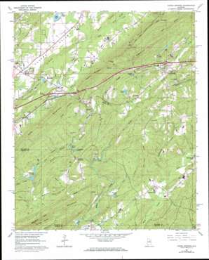
Cooks Springs Topo Map Alabama
To zoom in, hover over the map of Cooks Springs
USGS Topo Quad 33086e4 - 1:24,000 scale
| Topo Map Name: | Cooks Springs |
| USGS Topo Quad ID: | 33086e4 |
| Print Size: | ca. 21 1/4" wide x 27" high |
| Southeast Coordinates: | 33.5° N latitude / 86.375° W longitude |
| Map Center Coordinates: | 33.5625° N latitude / 86.4375° W longitude |
| U.S. State: | AL |
| Filename: | o33086e4.jpg |
| Download Map JPG Image: | Cooks Springs topo map 1:24,000 scale |
| Map Type: | Topographic |
| Topo Series: | 7.5´ |
| Map Scale: | 1:24,000 |
| Source of Map Images: | United States Geological Survey (USGS) |
| Alternate Map Versions: |
Cooks Springs AL 1962, updated 1964 Download PDF Buy paper map Cooks Springs AL 1962, updated 1984 Download PDF Buy paper map Cooks Springs AL 1962, updated 1984 Download PDF Buy paper map Cooks Springs AL 1975, updated 1977 Download PDF Buy paper map Cooks Springs AL 2011 Download PDF Buy paper map Cooks Springs AL 2014 Download PDF Buy paper map |
1:24,000 Topo Quads surrounding Cooks Springs
> Back to 33086e1 at 1:100,000 scale
> Back to 33086a1 at 1:250,000 scale
> Back to U.S. Topo Maps home
Cooks Springs topo map: Gazetteer
Cooks Springs: Capes
Stragglers Point elevation 337m 1105′Cooks Springs: Crossings
Interchange 147 elevation 219m 718′Interchange 152 elevation 193m 633′
Cooks Springs: Dams
Baptist Lake Dam elevation 195m 639′Birmingham Saw Works Lake Dam elevation 180m 590′
Halls Dam elevation 216m 708′
Hames Dam elevation 174m 570′
Hoover Dam elevation 219m 718′
Joyce Dam elevation 218m 715′
Luker Dam elevation 184m 603′
Purvis Dam elevation 203m 666′
Schneider Dam elevation 185m 606′
Cooks Springs: Gaps
Karr Gap elevation 226m 741′Suck Gap elevation 331m 1085′
Taylors Gap elevation 327m 1072′
Cooks Springs: Lakes
Hillhouse Lake elevation 168m 551′Cooks Springs: Pillars
Turtle Rock elevation 280m 918′Cooks Springs: Populated Places
Acmar elevation 246m 807′Brompton elevation 215m 705′
Cooks Springs elevation 165m 541′
Lawley elevation 143m 469′
Monte Bello Estates elevation 208m 682′
Moody elevation 211m 692′
Pleasant Grove elevation 149m 488′
Prescott elevation 176m 577′
Saint Clair Forest elevation 224m 734′
Spring Valley Estates elevation 219m 718′
Stewarts Crossroads elevation 174m 570′
Twin Lake Estates elevation 220m 721′
Valleyhaven elevation 217m 711′
Wolf Creek elevation 157m 515′
Cooks Springs: Post Offices
Acmar Post Office elevation 254m 833′Cooks Springs Post Office elevation 170m 557′
Cooks Springs: Reservoirs
Baptist Camp Lake elevation 195m 639′Browns Lake elevation 146m 479′
Catfish Lake elevation 222m 728′
Corbetts Lake elevation 178m 583′
Elliotts Lake elevation 185m 606′
Halls Lake elevation 216m 708′
Hames Lake elevation 174m 570′
Hoover Lake elevation 218m 715′
Lake Joyce elevation 218m 715′
Luker Lake elevation 185m 606′
Purvis Lake elevation 198m 649′
Schneider Lake elevation 177m 580′
Wolf Ranch Lake elevation 147m 482′
Cooks Springs: Ridges
Pea Vine Ridge elevation 233m 764′Taylors Mountain elevation 360m 1181′
Wolf Pen Ridge elevation 253m 830′
Cooks Springs: Streams
Cane Creek elevation 158m 518′Double Branch elevation 151m 495′
Head Springs elevation 204m 669′
Hearthstone Creek elevation 138m 452′
Jess Branch elevation 169m 554′
Kerr Branch elevation 205m 672′
Lee Branch elevation 174m 570′
Little Creek elevation 137m 449′
Patterson Branch elevation 147m 482′
Ram Horn Branch elevation 161m 528′
Shoal Creek elevation 136m 446′
Cooks Springs: Summits
Bald Rock Mountain elevation 475m 1558′Double Oak Mountain elevation 293m 961′
Hurst Hill elevation 259m 849′
Karr Mountain elevation 376m 1233′
Shoal Creek Mountain elevation 188m 616′
Tunnel Hill elevation 199m 652′
Cooks Springs: Tunnels
Cooks Springs Tunnel elevation 216m 708′Cooks Springs: Valleys
Hale Hollow elevation 231m 757′Jess Hollow elevation 168m 551′
Roaring Hollow elevation 218m 715′
Cooks Springs digital topo map on disk
Buy this Cooks Springs topo map showing relief, roads, GPS coordinates and other geographical features, as a high-resolution digital map file on DVD:


