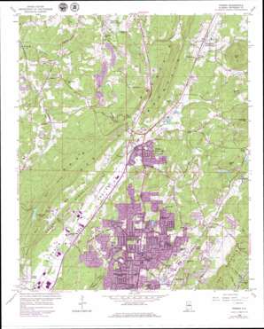
Pinson Topo Map Alabama
To zoom in, hover over the map of Pinson
USGS Topo Quad 33086f6 - 1:24,000 scale
| Topo Map Name: | Pinson |
| USGS Topo Quad ID: | 33086f6 |
| Print Size: | ca. 21 1/4" wide x 27" high |
| Southeast Coordinates: | 33.625° N latitude / 86.625° W longitude |
| Map Center Coordinates: | 33.6875° N latitude / 86.6875° W longitude |
| U.S. State: | AL |
| Filename: | o33086f6.jpg |
| Download Map JPG Image: | Pinson topo map 1:24,000 scale |
| Map Type: | Topographic |
| Topo Series: | 7.5´ |
| Map Scale: | 1:24,000 |
| Source of Map Images: | United States Geological Survey (USGS) |
| Alternate Map Versions: |
Pinson AL 1959, updated 1960 Download PDF Buy paper map Pinson AL 1959, updated 1960 Download PDF Buy paper map Pinson AL 1959, updated 1971 Download PDF Buy paper map Pinson AL 1959, updated 1977 Download PDF Buy paper map Pinson AL 1959, updated 1979 Download PDF Buy paper map Pinson AL 1959, updated 1987 Download PDF Buy paper map Pinson AL 1975, updated 1977 Download PDF Buy paper map Pinson AL 2011 Download PDF Buy paper map Pinson AL 2014 Download PDF Buy paper map |
1:24,000 Topo Quads surrounding Pinson
> Back to 33086e1 at 1:100,000 scale
> Back to 33086a1 at 1:250,000 scale
> Back to U.S. Topo Maps home
Pinson topo map: Gazetteer
Pinson: Dams
Camp Cosby Dam elevation 246m 807′Camp Cosby Lake Number 2 Dam elevation 254m 833′
Center Point Lake Dam elevation 231m 757′
Indian Valley Camp Lake Dam elevation 171m 561′
Turkey Creek Lake Dam elevation 226m 741′
Pinson: Gaps
Cunningham Gap elevation 191m 626′Sweeny Gap elevation 243m 797′
The Narrows elevation 187m 613′
Pinson: Lakes
Silver Lake elevation 207m 679′Pinson: Parks
Center Point Community Park elevation 256m 839′Pinson: Populated Places
Arrowhead elevation 244m 800′Bridlewood Forest Estates elevation 242m 793′
Carriage Hills elevation 226m 741′
Center Point elevation 253m 830′
Center Point Gardens elevation 249m 816′
Centercrest elevation 252m 826′
Centerwood Estates elevation 270m 885′
Chalkville elevation 266m 872′
Country Estates elevation 232m 761′
Crosston elevation 143m 469′
Fernwood Estates elevation 249m 816′
Fitzgerald Estates elevation 192m 629′
Forest Acres elevation 246m 807′
Gable Cove elevation 263m 862′
Godwin Estates elevation 244m 800′
Grayson Valley elevation 287m 941′
Heatherwood elevation 257m 843′
Holiday Park Estates elevation 262m 859′
Innsbrooke elevation 207m 679′
Larkwood elevation 266m 872′
Monmouth elevation 136m 446′
Morningside elevation 235m 770′
Northgate Trailer Park elevation 199m 652′
Overbrook Estates elevation 253m 830′
Palmerdale elevation 209m 685′
Palmerdale Trailer Park elevation 212m 695′
Pawnee Heights elevation 196m 643′
Pinson elevation 189m 620′
Ridgewood elevation 245m 803′
Sun Valley elevation 247m 810′
White Oaks elevation 199m 652′
Woodaire Estates elevation 229m 751′
Pinson: Post Offices
Palmerdale Post Office elevation 213m 698′Pinson: Reservoirs
Center Point Lake elevation 231m 757′Hilldale Farm Lake elevation 237m 777′
Indian Valley Camp Lake elevation 171m 561′
Old Camp Cosby Lake elevation 246m 807′
Shadow Lake elevation 226m 741′
Shadow Lake elevation 254m 833′
Pinson: Ridges
Gravel Ridge elevation 263m 862′Rocky Row elevation 276m 905′
Pinson: Streams
Beaver Creek elevation 177m 580′Dry Creek elevation 184m 603′
North Creek elevation 119m 390′
Pinson: Summits
Brushy Mountain elevation 324m 1062′Keeler Mountain elevation 345m 1131′
Miles Mountain elevation 386m 1266′
Pinson: Valleys
Poplar Spring elevation 264m 866′Red Hollow elevation 177m 580′
Sand Hollow elevation 171m 561′
Sand Valley elevation 194m 636′
Sweeney Hollow elevation 191m 626′
Pinson digital topo map on disk
Buy this Pinson topo map showing relief, roads, GPS coordinates and other geographical features, as a high-resolution digital map file on DVD:


