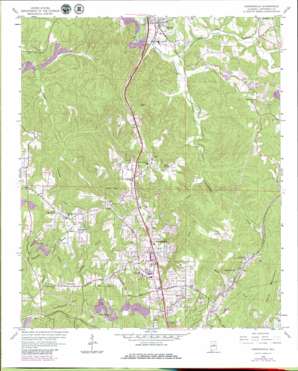
Gardendale Topo Map Alabama
To zoom in, hover over the map of Gardendale
USGS Topo Quad 33086f7 - 1:24,000 scale
| Topo Map Name: | Gardendale |
| USGS Topo Quad ID: | 33086f7 |
| Print Size: | ca. 21 1/4" wide x 27" high |
| Southeast Coordinates: | 33.625° N latitude / 86.75° W longitude |
| Map Center Coordinates: | 33.6875° N latitude / 86.8125° W longitude |
| U.S. State: | AL |
| Filename: | o33086f7.jpg |
| Download Map JPG Image: | Gardendale topo map 1:24,000 scale |
| Map Type: | Topographic |
| Topo Series: | 7.5´ |
| Map Scale: | 1:24,000 |
| Source of Map Images: | United States Geological Survey (USGS) |
| Alternate Map Versions: |
Gardendale AL 1959, updated 1960 Download PDF Buy paper map Gardendale AL 1959, updated 1971 Download PDF Buy paper map Gardendale AL 1959, updated 1989 Download PDF Buy paper map Gardendale AL 1975, updated 1977 Download PDF Buy paper map Gardendale AL 2011 Download PDF Buy paper map Gardendale AL 2014 Download PDF Buy paper map |
1:24,000 Topo Quads surrounding Gardendale
> Back to 33086e1 at 1:100,000 scale
> Back to 33086a1 at 1:250,000 scale
> Back to U.S. Topo Maps home
Gardendale topo map: Gazetteer
Gardendale: Airports
Parker Field elevation 179m 587′Roto Wing Inc Airport elevation 186m 610′
Gardendale: Crossings
Interchange 271 elevation 152m 498′Interchange 272 elevation 207m 679′
Interchange 275 elevation 202m 662′
Gardendale: Dams
Flat Creek Lake Dam elevation 124m 406′Gardendale: Gaps
Jackson Gap elevation 235m 770′Gardendale: Mines
Alabama Mine elevation 201m 659′Clift Mines elevation 153m 501′
Cosmo Mine elevation 166m 544′
Eldorda Number 2 Mine elevation 203m 666′
Graves Mine elevation 207m 679′
Milner Mine elevation 203m 666′
Morris North Mine elevation 139m 456′
Gardendale: Parks
Wildcat Stadium elevation 195m 639′Gardendale: Populated Places
Cunningham elevation 156m 511′Fieldstown elevation 173m 567′
Gardendale elevation 207m 679′
Majestic elevation 127m 416′
Morris elevation 127m 416′
Mount Olive elevation 185m 606′
New Castle elevation 162m 531′
Gardendale: Reservoirs
Flat Creek Lake elevation 124m 406′Gardendale: Ridges
Bagley Ridge elevation 168m 551′Shell Ridge elevation 168m 551′
Gardendale: Springs
Barrell Spring elevation 195m 639′Buckhorn Spring elevation 167m 547′
Gardendale: Streams
Black Creek elevation 118m 387′Cunningham Creek elevation 108m 354′
Flat Creek elevation 110m 360′
Halfway Branch elevation 123m 403′
Mineral Branch elevation 135m 442′
Sectionline Creek elevation 119m 390′
Gardendale: Summits
Easterwood Mountain elevation 232m 761′Yellow Bird Mountain elevation 215m 705′
Gardendale digital topo map on disk
Buy this Gardendale topo map showing relief, roads, GPS coordinates and other geographical features, as a high-resolution digital map file on DVD:


