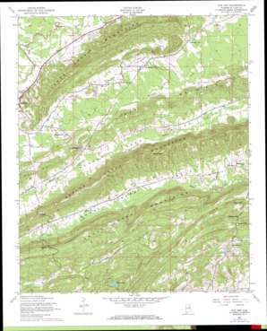
Cox Gap Topo Map Alabama
To zoom in, hover over the map of Cox Gap
USGS Topo Quad 33086g2 - 1:24,000 scale
| Topo Map Name: | Cox Gap |
| USGS Topo Quad ID: | 33086g2 |
| Print Size: | ca. 21 1/4" wide x 27" high |
| Southeast Coordinates: | 33.75° N latitude / 86.125° W longitude |
| Map Center Coordinates: | 33.8125° N latitude / 86.1875° W longitude |
| U.S. State: | AL |
| Filename: | o33086g2.jpg |
| Download Map JPG Image: | Cox Gap topo map 1:24,000 scale |
| Map Type: | Topographic |
| Topo Series: | 7.5´ |
| Map Scale: | 1:24,000 |
| Source of Map Images: | United States Geological Survey (USGS) |
| Alternate Map Versions: |
Cox Gap AL 1947, updated 1948 Download PDF Buy paper map Cox Gap AL 1947, updated 1953 Download PDF Buy paper map Cox Gap AL 1947, updated 1973 Download PDF Buy paper map Cox Gap AL 1947, updated 1984 Download PDF Buy paper map Cox Gap AL 1975, updated 1977 Download PDF Buy paper map Cox Gap AL 2011 Download PDF Buy paper map Cox Gap AL 2014 Download PDF Buy paper map |
1:24,000 Topo Quads surrounding Cox Gap
> Back to 33086e1 at 1:100,000 scale
> Back to 33086a1 at 1:250,000 scale
> Back to U.S. Topo Maps home
Cox Gap topo map: Gazetteer
Cox Gap: Dams
Baswell Dam elevation 183m 600′Borders Dam elevation 193m 633′
Cox Gap: Gaps
Cox Gap elevation 251m 823′Gibson Gap elevation 202m 662′
Horseshoe Gap elevation 239m 784′
Leighton Gap elevation 180m 590′
Looney Gap elevation 261m 856′
Nichols Gap elevation 275m 902′
Cox Gap: Reservoirs
Baswell Lake elevation 183m 600′Borders Lake elevation 186m 610′
Morgan Lake elevation 176m 577′
Cox Gap: Ridges
Backbone Ridge elevation 237m 777′Canoe Creek Mountains elevation 324m 1062′
Shoal Creek Mountains elevation 231m 757′
Cox Gap: Streams
Gulf Creek elevation 159m 521′Whiteoak Creek elevation 178m 583′
Cox Gap digital topo map on disk
Buy this Cox Gap topo map showing relief, roads, GPS coordinates and other geographical features, as a high-resolution digital map file on DVD:


