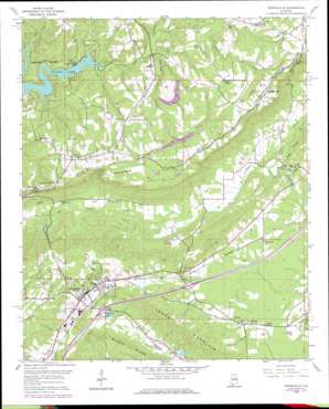
Springville Topo Map Alabama
To zoom in, hover over the map of Springville
USGS Topo Quad 33086g4 - 1:24,000 scale
| Topo Map Name: | Springville |
| USGS Topo Quad ID: | 33086g4 |
| Print Size: | ca. 21 1/4" wide x 27" high |
| Southeast Coordinates: | 33.75° N latitude / 86.375° W longitude |
| Map Center Coordinates: | 33.8125° N latitude / 86.4375° W longitude |
| U.S. State: | AL |
| Filename: | o33086g4.jpg |
| Download Map JPG Image: | Springville topo map 1:24,000 scale |
| Map Type: | Topographic |
| Topo Series: | 7.5´ |
| Map Scale: | 1:24,000 |
| Source of Map Images: | United States Geological Survey (USGS) |
| Alternate Map Versions: |
Springville AL 1958, updated 1960 Download PDF Buy paper map Springville AL 1958, updated 1972 Download PDF Buy paper map Springville AL 1958, updated 1978 Download PDF Buy paper map Springville AL 1958, updated 1978 Download PDF Buy paper map Springville AL 1975, updated 1977 Download PDF Buy paper map Springville AL 2011 Download PDF Buy paper map Springville AL 2014 Download PDF Buy paper map |
1:24,000 Topo Quads surrounding Springville
> Back to 33086e1 at 1:100,000 scale
> Back to 33086a1 at 1:250,000 scale
> Back to U.S. Topo Maps home
Springville topo map: Gazetteer
Springville: Crossings
Interchange 154 elevation 218m 715′Interchange 156 elevation 203m 666′
Smiths Ferry (historical) elevation 366m 1200′
Springville: Dams
Burch Dam elevation 201m 659′Elam Dam elevation 234m 767′
Harbert Dam elevation 230m 754′
Hickman Dam elevation 211m 692′
Howell Dam elevation 215m 705′
Springville: Gaps
Hooper Gap elevation 381m 1250′McClendon Gap elevation 388m 1272′
Springville: Mines
Harvey Mine elevation 346m 1135′Springville: Populated Places
Goodwins Mill elevation 198m 649′Holly Springs elevation 373m 1223′
Saint Clair Springs elevation 201m 659′
Springville elevation 221m 725′
Springville: Reservoirs
Burch Lake elevation 201m 659′Canoe Lake elevation 206m 675′
Elam Lake elevation 234m 767′
Harbert Lake elevation 230m 754′
Hickman Lake elevation 210m 688′
Mountain View Lake elevation 215m 705′
Springville: Ridges
Buck Ridge elevation 395m 1295′Middle Ridge elevation 256m 839′
Springville: Springs
Herrings Big Spring elevation 218m 715′Springville: Streams
Box Creek elevation 241m 790′Difficulty Branch elevation 256m 839′
Fall Branch elevation 239m 784′
Woodard Creek elevation 240m 787′
Springville: Summits
Jones Mountain elevation 313m 1026′Springville digital topo map on disk
Buy this Springville topo map showing relief, roads, GPS coordinates and other geographical features, as a high-resolution digital map file on DVD:


