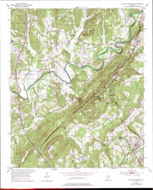
Blount Springs Topo Map Alabama
To zoom in, hover over the map of Blount Springs
USGS Topo Quad 33086h7 - 1:24,000 scale
| Topo Map Name: | Blount Springs |
| USGS Topo Quad ID: | 33086h7 |
| Print Size: | ca. 21 1/4" wide x 27" high |
| Southeast Coordinates: | 33.875° N latitude / 86.75° W longitude |
| Map Center Coordinates: | 33.9375° N latitude / 86.8125° W longitude |
| U.S. State: | AL |
| Filename: | o33086h7.jpg |
| Download Map JPG Image: | Blount Springs topo map 1:24,000 scale |
| Map Type: | Topographic |
| Topo Series: | 7.5´ |
| Map Scale: | 1:24,000 |
| Source of Map Images: | United States Geological Survey (USGS) |
| Alternate Map Versions: |
Blount Springs AL 1951, updated 1952 Download PDF Buy paper map Blount Springs AL 1951, updated 1972 Download PDF Buy paper map Blount Springs AL 1951, updated 1978 Download PDF Buy paper map Blount Springs AL 1951, updated 1978 Download PDF Buy paper map Blount Springs AL 1975, updated 1977 Download PDF Buy paper map Blount Springs AL 2011 Download PDF Buy paper map Blount Springs AL 2014 Download PDF Buy paper map |
1:24,000 Topo Quads surrounding Blount Springs
> Back to 33086e1 at 1:100,000 scale
> Back to 33086a1 at 1:250,000 scale
> Back to U.S. Topo Maps home
Blount Springs topo map: Gazetteer
Blount Springs: Basins
The Sink elevation 211m 692′Blount Springs: Crossings
Exit 287 elevation 172m 564′Exit 289 elevation 128m 419′
Interchange 292 elevation 125m 410′
Sapp Ford elevation 92m 301′
Blount Springs: Gaps
Copperas Gap elevation 137m 449′Johnson Gap elevation 217m 711′
Reid Gap elevation 181m 593′
Blount Springs: Parks
Rickwood Caverns State Park elevation 299m 980′Blount Springs: Populated Places
Bangor elevation 145m 475′Bent Tree elevation 152m 498′
Black Bottom elevation 98m 321′
Blount Springs elevation 138m 452′
Damascus elevation 146m 479′
Hayden elevation 172m 564′
Reids elevation 167m 547′
Smoke Rise elevation 310m 1017′
Sulpher Springs elevation 136m 446′
Blount Springs: Post Offices
Hayden Post Office elevation 172m 564′Blount Springs: Springs
Chalybeate Spring elevation 198m 649′Cold Spring elevation 123m 403′
Sulphur Spring elevation 153m 501′
Blount Springs: Streams
Dairy Creek elevation 155m 508′Dry Creek elevation 123m 403′
James Creek elevation 91m 298′
Marriott Creek elevation 91m 298′
Mill Creek elevation 91m 298′
Murphy Creek elevation 122m 400′
Thacker Creek elevation 91m 298′
Town Creek elevation 91m 298′
Blount Springs: Summits
Barefoot Mountain elevation 185m 606′Bryant Mountain elevation 352m 1154′
Duffy Mountain elevation 279m 915′
Hamilton Mountain elevation 306m 1003′
Hayden Mountain elevation 262m 859′
Huffman Mountain elevation 204m 669′
Spring Yard Hill elevation 232m 761′
Blount Springs: Tunnels
Blount Tunnel elevation 216m 708′Hayden Tunnel elevation 234m 767′
Blount Springs: Valleys
Harrell Cove elevation 155m 508′Blount Springs digital topo map on disk
Buy this Blount Springs topo map showing relief, roads, GPS coordinates and other geographical features, as a high-resolution digital map file on DVD:


