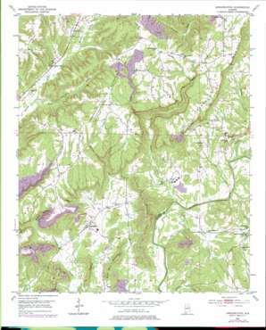
Arkadelphia Topo Map Alabama
To zoom in, hover over the map of Arkadelphia
USGS Topo Quad 33086h8 - 1:24,000 scale
| Topo Map Name: | Arkadelphia |
| USGS Topo Quad ID: | 33086h8 |
| Print Size: | ca. 21 1/4" wide x 27" high |
| Southeast Coordinates: | 33.875° N latitude / 86.875° W longitude |
| Map Center Coordinates: | 33.9375° N latitude / 86.9375° W longitude |
| U.S. State: | AL |
| Filename: | o33086h8.jpg |
| Download Map JPG Image: | Arkadelphia topo map 1:24,000 scale |
| Map Type: | Topographic |
| Topo Series: | 7.5´ |
| Map Scale: | 1:24,000 |
| Source of Map Images: | United States Geological Survey (USGS) |
| Alternate Map Versions: |
Arkadelphia AL 1951, updated 1952 Download PDF Buy paper map Arkadelphia AL 1951, updated 1974 Download PDF Buy paper map Arkadelphia AL 1951, updated 1978 Download PDF Buy paper map Arkadelphia AL 1951, updated 1978 Download PDF Buy paper map Arkadelphia AL 1975, updated 1977 Download PDF Buy paper map Arkadelphia AL 2011 Download PDF Buy paper map Arkadelphia AL 2014 Download PDF Buy paper map |
1:24,000 Topo Quads surrounding Arkadelphia
> Back to 33086e1 at 1:100,000 scale
> Back to 33086a1 at 1:250,000 scale
> Back to U.S. Topo Maps home
Arkadelphia topo map: Gazetteer
Arkadelphia: Crossings
Baltimore Ford elevation 87m 285′Arkadelphia: Dams
Forrest Ingram Dam elevation 85m 278′Arkadelphia: Mines
Arkadelphia Mine elevation 158m 518′Clefty Mine elevation 204m 669′
Juliana Drift Mine elevation 213m 698′
Tremble Mine elevation 230m 754′
Arkadelphia: Populated Places
Arkadelphia elevation 112m 367′Baltimore (historical) elevation 92m 301′
Bremen elevation 172m 564′
Danzler elevation 211m 692′
The Colony elevation 140m 459′
Arkadelphia: Post Offices
Arkadelphia Post Office elevation 113m 370′Arkadelphia: Reservoirs
Ingram Arkadelphia Lake elevation 85m 278′Arkadelphia: Streams
Clarkton Creek elevation 91m 298′Dean Creek elevation 87m 285′
Dollar Creek elevation 110m 360′
James Creek elevation 100m 328′
Rice Creek elevation 85m 278′
Stony Lonesome Branch elevation 138m 452′
Arkadelphia: Summits
Arkadelphia Mountain elevation 236m 774′Burt Reid Mountain elevation 179m 587′
Cannon Mountain elevation 190m 623′
Little Mountain elevation 221m 725′
Prospect Mountain elevation 263m 862′
Arkadelphia: Valleys
Dorsey Creek Valley elevation 135m 442′Wildcat Hollow elevation 96m 314′
Arkadelphia digital topo map on disk
Buy this Arkadelphia topo map showing relief, roads, GPS coordinates and other geographical features, as a high-resolution digital map file on DVD:


