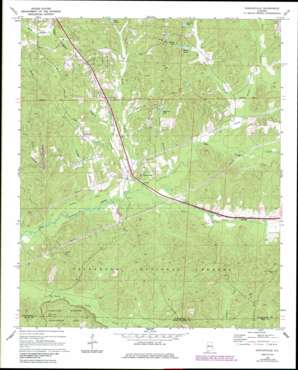
Duncanville Topo Map Alabama
To zoom in, hover over the map of Duncanville
USGS Topo Quad 33087a4 - 1:24,000 scale
| Topo Map Name: | Duncanville |
| USGS Topo Quad ID: | 33087a4 |
| Print Size: | ca. 21 1/4" wide x 27" high |
| Southeast Coordinates: | 33° N latitude / 87.375° W longitude |
| Map Center Coordinates: | 33.0625° N latitude / 87.4375° W longitude |
| U.S. State: | AL |
| Filename: | o33087a4.jpg |
| Download Map JPG Image: | Duncanville topo map 1:24,000 scale |
| Map Type: | Topographic |
| Topo Series: | 7.5´ |
| Map Scale: | 1:24,000 |
| Source of Map Images: | United States Geological Survey (USGS) |
| Alternate Map Versions: |
Duncanville AL 1969, updated 1972 Download PDF Buy paper map Duncanville AL 1969, updated 1972 Download PDF Buy paper map Duncanville AL 1969, updated 1985 Download PDF Buy paper map Duncanville AL 2002, updated 2003 Download PDF Buy paper map Duncanville AL 2011 Download PDF Buy paper map Duncanville AL 2014 Download PDF Buy paper map |
| FStopo: | US Forest Service topo Duncanville is available: Download FStopo PDF Download FStopo TIF |
1:24,000 Topo Quads surrounding Duncanville
> Back to 33087a1 at 1:100,000 scale
> Back to 33086a1 at 1:250,000 scale
> Back to U.S. Topo Maps home
Duncanville topo map: Gazetteer
Duncanville: Crossings
Fosters Ferry (historical) elevation 98m 321′Duncanville: Dams
Lake Judson Dam elevation 90m 295′Steiner Lake Dam elevation 84m 275′
Duncanville: Populated Places
Duncanville elevation 74m 242′Monticello Estates elevation 119m 390′
Monticello Two elevation 101m 331′
Raintree Country elevation 104m 341′
Duncanville: Post Offices
Duncanville Post Office elevation 67m 219′Duncanville: Reservoirs
Matthews Lake elevation 73m 239′Pattons Lake elevation 93m 305′
Skyview Lake elevation 87m 285′
Steiner Lake elevation 88m 288′
Duncanville: Streams
Bear Creek elevation 53m 173′Bunch Creek elevation 54m 177′
Counters Branch elevation 55m 180′
Darden Branch elevation 49m 160′
Flint Branch elevation 67m 219′
Horse Creek elevation 60m 196′
Indian Creek elevation 48m 157′
Little Indian Creek elevation 58m 190′
Lye Branch elevation 59m 193′
Tadpole Creek elevation 55m 180′
Duncanville: Summits
Sand Mountain elevation 149m 488′Duncanville digital topo map on disk
Buy this Duncanville topo map showing relief, roads, GPS coordinates and other geographical features, as a high-resolution digital map file on DVD:


