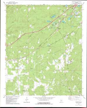
Woodstock Topo Map Alabama
To zoom in, hover over the map of Woodstock
USGS Topo Quad 33087b2 - 1:24,000 scale
| Topo Map Name: | Woodstock |
| USGS Topo Quad ID: | 33087b2 |
| Print Size: | ca. 21 1/4" wide x 27" high |
| Southeast Coordinates: | 33.125° N latitude / 87.125° W longitude |
| Map Center Coordinates: | 33.1875° N latitude / 87.1875° W longitude |
| U.S. State: | AL |
| Filename: | o33087b2.jpg |
| Download Map JPG Image: | Woodstock topo map 1:24,000 scale |
| Map Type: | Topographic |
| Topo Series: | 7.5´ |
| Map Scale: | 1:24,000 |
| Source of Map Images: | United States Geological Survey (USGS) |
| Alternate Map Versions: |
Woodstock AL 1980, updated 1980 Download PDF Buy paper map Woodstock AL 1980, updated 1989 Download PDF Buy paper map Woodstock AL 2011 Download PDF Buy paper map Woodstock AL 2014 Download PDF Buy paper map |
1:24,000 Topo Quads surrounding Woodstock
> Back to 33087a1 at 1:100,000 scale
> Back to 33086a1 at 1:250,000 scale
> Back to U.S. Topo Maps home
Woodstock topo map: Gazetteer
Woodstock: Crossings
Interchange 97 elevation 198m 649′Woodstock: Dams
Mud Lake Dam elevation 171m 561′Robinson Lake Dam elevation 183m 600′
Woodstock: Lakes
Beaver Pond elevation 184m 603′Blue Hole elevation 180m 590′
Gallant Lake elevation 162m 531′
Giles Lake elevation 197m 646′
Miller Lake elevation 168m 551′
Woodland Lake elevation 174m 570′
Woodstock: Mines
Houston Mine elevation 188m 616′Martaban Mine elevation 204m 669′
Woodward Mine elevation 170m 557′
Woodstock: Parks
Holiday Beach elevation 170m 557′Woodstock: Populated Places
Academy Park elevation 174m 570′Banks elevation 152m 498′
Bibbville elevation 163m 534′
Blockton Junc elevation 155m 508′
Burmah (historical) elevation 176m 577′
Caffee Junction elevation 199m 652′
Chambers elevation 191m 626′
Chamblee elevation 192m 629′
Docray elevation 178m 583′
Dowdle elevation 147m 482′
Giles elevation 196m 643′
Green Pond elevation 181m 593′
North Bibb elevation 176m 577′
Shawtown elevation 178m 583′
Vance elevation 155m 508′
Woodstock elevation 169m 554′
Woodstock Junction elevation 192m 629′
Woodstock: Post Offices
Green Pond Post Office elevation 179m 587′Vance Post Office elevation 159m 521′
Woodstock Post Office elevation 162m 531′
Woodstock: Reservoirs
Blue Pond elevation 144m 472′McMicken Lake elevation 180m 590′
Robinson Lake elevation 183m 600′
Woodstock: Streams
Banks Creek elevation 121m 396′Gaffney Branch elevation 159m 521′
Johnson Creek elevation 150m 492′
Thomas Branch elevation 176m 577′
Woodstock digital topo map on disk
Buy this Woodstock topo map showing relief, roads, GPS coordinates and other geographical features, as a high-resolution digital map file on DVD:


